Annapurna Circuit Route follows a long and classic Himalayan path that circles the massive Annapurna region in anti-clockwise direction. total distance of the classic Annapurna Circuit is typically 160–175 km of trekking, which includes the Ghorepani Poon Hill trek for breathtaking sunrise views. Starting from lower river valleys of Marsyangdi, the trail gradually climbs through different villages like Upper Pisang, Manang (3,540 m) and Thorong Phedi (4,450 m) before reaching at Thorong La Pass (5,416 m) which is the highest pass in the world. The route then descends towards Muktinath (3,760 m) and continues into Kali Gandaki valley, showing a complete shift in landscapes from green forests to dry high altitude desert.
trail condition is well-marked and mostly stone-step or footpath, but steeper sections near the pass and some exposed ridges requires careful walking. This Annapurna Circuit Trekking route also offers the cultural experience of Gurung, Magar, and Thakali villages like Marpha and Manang along with different monasteries, chortens, mani walls and temples. Trail is mostly well marked with stone steps and footpaths, though some sections are steep, rocky or icy depending upon the season. Driving roads are mostly paved but can be bumpy in some parts during the journey. Higher parts of the route can be icy or snowy in winter, but the path is safe and moderate in good season if you walk steadily. Trekkers will leave with rich insights and life long memories of the Marsyangdi and Kali Gandaki valleys upon completing the Annapurna Circuit journey, making it as a top choice for adventurers.
Annapurna Circuit Trek: What It Really Looks Like? A Complete Visual Guide
The Annapurna Circuit Trek unfolds as a journey through ever-changing landscapes, from lush green valleys to rugged high-altitude deserts beneath giant Himalayan peaks. Each day on Annapurna Circuit Trekking route reveals trekkers a new scenery, cultures, and challenges, while offering a realistic experience of mountain life, as described in the detailed daily trail sections below.
Day 1: Kathmandu to Chame Drive
Kathmandu (1,400 meters) to Chame (2,670 meters) drive involves a long journey of about 238 km which takes 9 to 10 hours. The road condition is mostly paved until Besisahar but becomes bumpier on the off-road section to Chame.
A: Kathmandu to Besisahar:The drive from Kathmandu to Besisahar is about 175 km and usually takes 6 to 8 hours by tourist bus or private jeep, depending upon the traffic and road conditions. We will travel along the Prithivi Highway beside the Trishuli River. From Dumre, the route climbs into the hills along the Marsyangdi River valley. The road is paved but narrow and winding as it passes rural farms and villages. Upon reaching Besisahar we will take a jeep and drive towards Chame village.
Section B: Besisahar to Chame:The drive from Besisahar to Chame covers roughly 66 km and usually takes about 4 to 5 hours by jeep. This track is a rough high mountain road that passes through villages such as Jagat, Dharapani, and Timang. The road is narrow and unpaved in some sections with towering cliffs and many waterfalls along the way. You must verify your permits at the ACAP checkpoint in Dharapani or sometimes Jagat. The route climbs from low landscapes into higher alpine valleys with mountain views offering trekkers a gradual introduction to the Annapurna region through scenic river valleys and Gurung villages.
Day 2: Chame to Upper Pisang
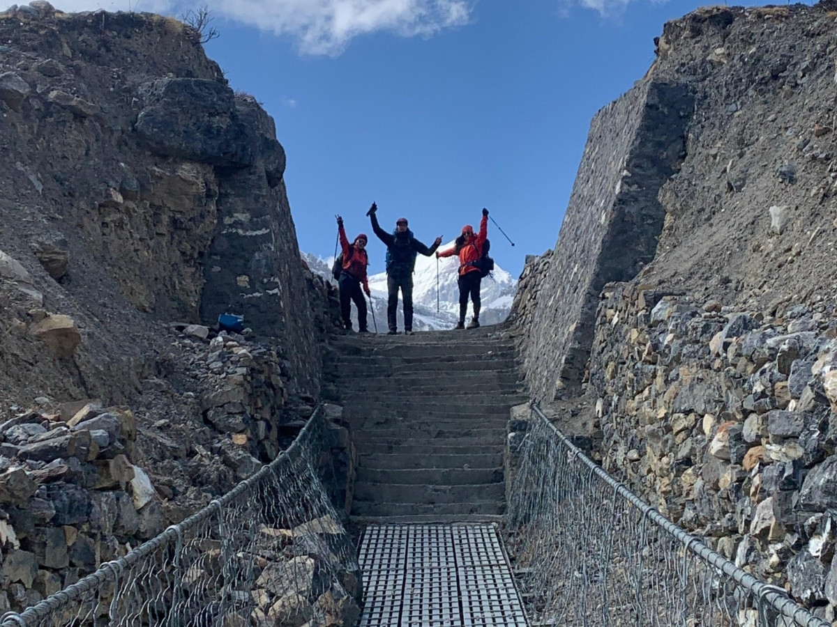
This day involves an uphill gradual walk from 2,650 m in Chame to roughly 3,300 m in Upper Pisang. This trek takes around 5 to 6 hours of walking and covers distance of 14km. The trail starts forest lined along the Marsyangdi River then opens up into dramatic mountain scenery as we approach towards Pisang. You will cross Swargadwari suspension bridge over the Marsyangdi river during the day.
Section A: Chame to Swargadwari:Section walk is around 4 to 5 km to Swargadwari Bridge which takes roughly about 1.5 to 2 hours. The trail follows an off-road path with the Marsyangdi River on left. Trekkers pass through Talekhu Stupa, fields, small streams, and lush forests of pine and rhododendron. The walk feels easy with the sound of the river and birds around you. At the end, you cross the Marsyangdi River on the first Swargadwari suspension bridge. This wide cable bridge sways a little but stays solid and offers good views back toward Chame and the lower hills.
Section B: Swargadwari Bridge to Dhikur Pokhari:This section of trek from Swargadwari Bridge to Dhikur Pokhari cover about 5 to 6 km in roughly 2 to 2.5 hours, depending on your pace and rest breaks. The trail climbs from around 2,800 meters near the bridge up to about 3,100 meters at Dhikur Pokhari. The path has rocky switchback sections and some loose gravel so you must watch your steps on exposed corners. Dhikur Pokhari is a high valley marshland that feels quiet and remote.
Section C: Dhikur Pokhari to Upper Pisang:From Dhikur Pokhari to Upper Pisang, the trail covers around 3 to 4 kilometers and takes roughly two to two and a half hours with short breaks. The path grows narrower, rockier and steeper, with many short stone steps. On cloudy or windy days, it feels more exposed, so good boots and trekking poles becomes very important. The last climb to reach Pisang feels the steepest of the day. On Pisang the air feels crisp and quiet, and old gompa on the ridge serves as a spectacular viewpoint.
Day 3: Upper Pisang to Manang
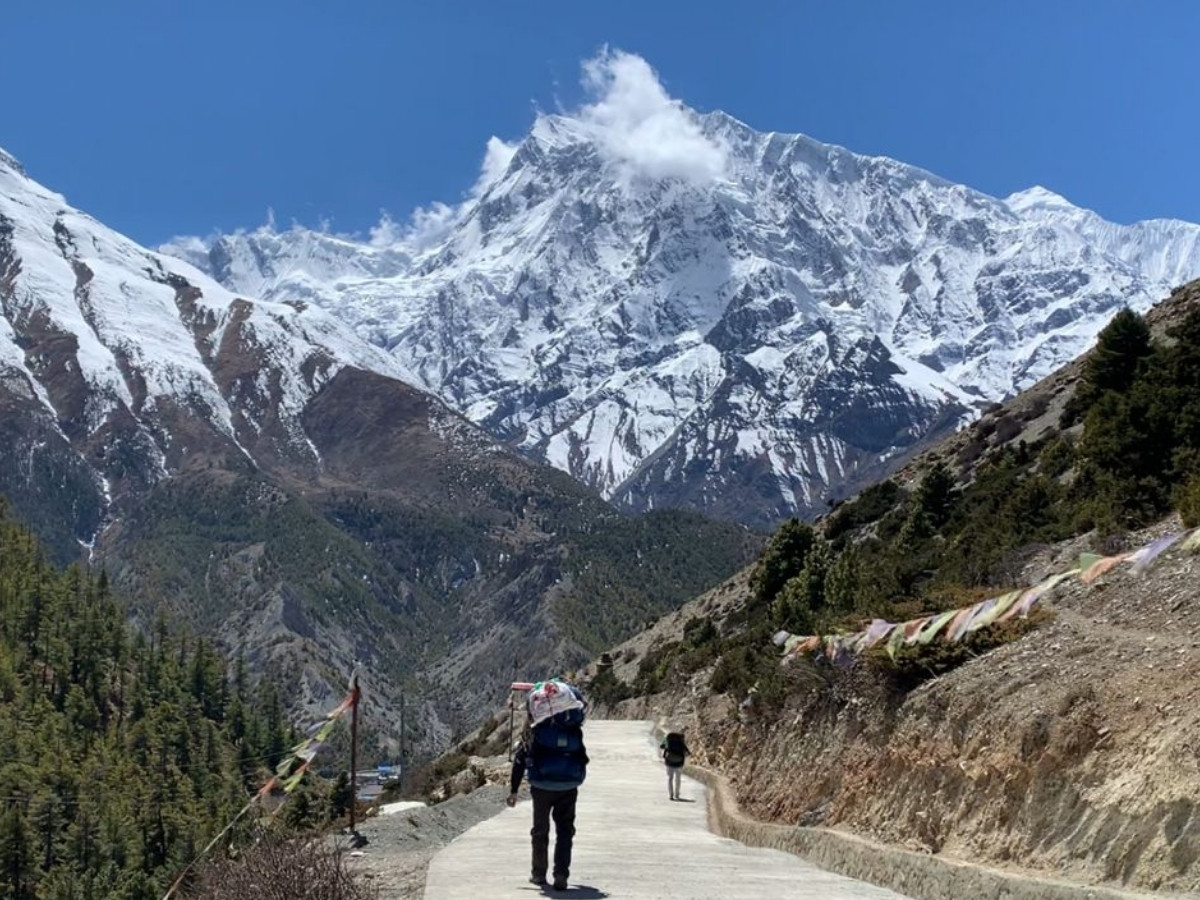
The third day of Annapurna Circuit Trekking Route involves a walk from Upper Pisang (3,300 meters) to Manang (3,540 meters) covering about 16 km and takes 9-10 hours. This high route is steeper but offers breathtaking views. Trekkers will notice that the trail conditions are drier on the upper path with rocky sections. As we approach towards the destination, we can see big valley scenes at the end of the day. The landscape opens up significantly as we reach the village, providing a great sense of the high mountain environment.
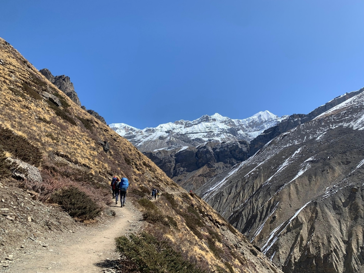
Section A: Upper Pisang to Ghyaru:The walk from Upper Pisang to Ghyaru covers around 4-5 km and takes about 3 hours. The path is slightly gradual down at first and then transitions into a flat easy walk for 40 to 50 minutes. If trekkers wants to visit, there is also green lake in between the trails. After you cross a suspension bridge, you face an acute uphill climb to Ghyaru village which is the hardest part of the day. The trail conditions are steep and rocky on the dry hillside. Upon reaching Ghyaru wide views begin immediately and you stand almost at the eye level with Annapurna II and Lamjung Himal. These open slopes offer excellent panoramas of the Himalayan range and the valley.
Section B: Ghyaru to Ngawal:The trek from Ghyaru to Ngawal covers around 5 to 6 km and takes about 3 hours. After Ghyaru, the path becomes a high ridge traverse with a gradual uphill climb on an unpaved road. The trail is generally dry and narrow in places, which can feel windy on the exposed paths. This section offers a breathtaking view and is one of the most scenic parts of the circuit. You enjoy continuous mountain views across the Marsyangdi Valley including the snowy peaks of Annapurna II and III. Both Ghyaru and Ngawal are stone villages with old houses and prayer flags that give a strong Tibetan feel to the journey.
Section C: Ngawal to Manang:From Ngawal, the path starts with a slight gradual downhill and then turns to concrete road for a while. This part makes the legs ache for most of the trekkers. After that, the route becomes unpaved road most of the way, passing through Munchi and Braga village before reaching Manang. The total distance is around 7-8 km and takes about 3-4 hours. From Munchi you see a jaw dropping view of Manang. The path is wider and more comfortable here although the altitude still requires effort. Braga Monastery is a famous cultural stop on this stretch. Some people stay in Braga to visit Ice Lake at 4,600 m. The scenery opens up with views of Gangapurna and the broad Manang valley as you reach the village.
Day 4: Acclimatization Day
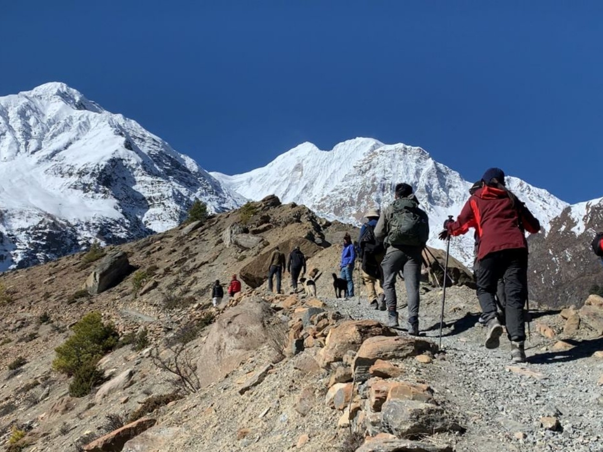
An acclimatization day at Manang village during Annapurna Circuit Trekking involves light activity to help your body adjust to the high altitude (3,540 meters). On this acclimatization day, trekkers can take a short scenic walk to Gangapurna Lake and the glacier viewpoint which takes about 1 to 2 hours. Gangapurna Lake offers views of a turquoise glacial lake and close up sights of the glacier. Another option is a relaxed walk to Braga Monastery. Braga Monastery is believed to be 900-year-old site and contains ancient statues and colorful murals that provide great cultural immersion on Annapurna Circuit Trekking Route.
a more active climb, you can hike to the top of the hill viewpoint which takes about 3 hours round trip. Reaching this hilltop provides sweeping views of Annapurna II, III, and IV with prayer flags fluttering in the wind. Trekkers can also wander through the Manang village old quarter or museum to see local prayer wheels and mani walls. It is important to relax and recover by drinking plenty of fluids and eating hearty meals like Dal Bhat at local tea houses on this day.
Day 5: Manang to Leder
5th day on Annapurna Circuit Trek Itinerary involves a mix of gradual uphill climb and flat natural trail from Manang to Leder covering around 12 km. walk takes about 7-8 hours on a well-marked rocky path passing through villages like Ghusang and Yak Kharka while enjoying views of Annapurna III, Pisang and Chulu peaks. Leder village is located at an altitude of 4,250 m among high yak pastures and herder shelters.
Section A: Manang to Ghusang (Gunsang):Trail from Manang to Ghusang covers roughly 4 km and takes about 2-3 hours of walking. Trekkers leave Manang and climb gently up the valley on a natural path. The trail is wide and clearly marked with a moderate incline that passes through the high-altitude village of Tengi (3,690 meters). You will find simple tea stops and shops where you start to gain altitude. The section of Annapurna Circuit Trek route can be dusty but it is not difficult.
Section B: Ghusang (Gunsang) to Ledar via Yak Kharka:Trek from Ghusang (Gunsang) to Ledar via Yak Kharka on Annapurna Circuit Route covers around 7-8 Km and takes about 5 hours to reach Ledar. The path is gradual uphill at first and then turns into a flat natural trail. Trekkers cross a suspension bridge before reaching Yak Kharka which is a high-altitude village (4,050 meters) with yak shelters and grazing pastures. After having lunch in Yak Kharka, we cross another suspension bridge and climb uphill to reach Ledar village at an altitude of 4,200 meters. On this trail, trekkers can witness herds of yaks and local stone shelters along the way. This section offers the breathtaking views of Chulu West, Thorong Peak, Annapurna II and Tilicho Peak. Ledar is a small settlement where the air feels thin and environment becomes really peaceful. This day is a clear step into the high altitude with a rewarding finish in the upper Marsyangdi valley.
Day 6: Ledar to High Camp
The 6th day of Annapurna Circuit Trek Itinerary is a short but tough climb from Leder to High Camp. Trekkers need to walk roughly 6-7 km over 8 hours. The path is rocky and dry with a net altitude gain of 700 m. Expect cold wind and thin air as you reach 4,925 m.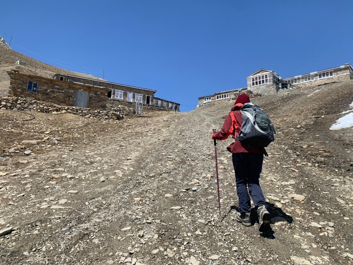
Section A: Ledar to Thorong Phedi: The walk from Ledar to Thorong Phedi begins with a gradual uphill climb on a rocky and dry trail. After you cross a suspension bridge the path stays slightly uphill. The total distance is about 5 km and takes about 5 hours. This area is a landslide risk zone so you must be careful while walking. There is an alternate upward trail before the bridge that takes one hour longer but offers better safety and views. You will pass a small teashop where you can rest. On the way, trekkers can enjoy the breathtaking snow-covered mountain views including Annapurna II, Annapurna III, Gangapurna and more. Most trekkers stop at basic lodges at Thorong Phedi for tea before the final push to High Camp.
Section B: Thorong Phedi to High Camp: The climb from Thorong Phedi to High Camp is an acute uphill walk of about 2 -3 hours. You cover about 2 km on a steep path made of stone steps and gravel. The trail is fully exposed with no trees and the ground can be icy or loose. You gain 400 m in altitude to reach 4,925 m where the air is thin and windy. You must make sure you have booked a hotel because if you do not you may need to go back down to sleep. High Camp offers direct views of Dhaulagiri and Nilgiri peaks. Take enough rest here and inform your guide if you feel a headache or dizziness. This last stop makes the next day crossing feel more realistic. Tomorrow is the most challenging day in our Annapurna Circuit Trekking Route so prepare well.
Day 7: High Camp to Muktinath
This day on Annapurna Circuit Route from High Camp to Muktinath is the biggest and most challenging day of the Annapurna Circuit. You walk about 15 km over 7 to 10 hours. The day starts with a climb to Thorong La at 5,416 m then ends with a long drop to Muktinath at 3,760 m. Trekkers must start very early around 4 AM to avoid strong afternoon winds on the high pass. This steep and exposed journey is a test of your endurance and acclimatization. Reaching the top is a great achievement before the long descent to Muktinath.
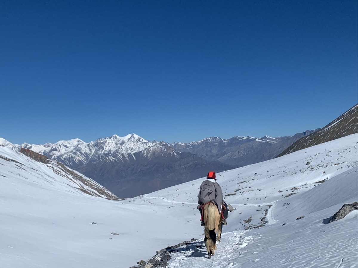
Section A: High Camp to Thorong La Pass:Trek from High Camp (4,925 m) to Thorong La Pass (5,416 m) covers about 4 km and takes roughly 5 hours of steady uphill walking. Trekkers should start walking early in the morning to avoid any unpredictable weather changes. The trekking trail includes stone steep to reach the Thorong La Pass at 5,416 meters. You gain about 500 m of altitude in this section which makes the air feel heavy. There is a small teashop along the way where trekkers can have tea and rest for a while. The top Thorong La Pass, world’s highest pass is marked by a large prayer flag and offers 360-degree panoramic views of Annapurna and Dhaulagiri Mountain ranges including Thorong Peak, Chulu west and Nilgiri.
Section B: Thorong La Pass to Phedi:Trek from Thorong La Pass to Phedi involves an acute downhill walk covering about 6 km. This section takes around 3 hours of continuous movement. You often need crampons because snowfall can make the steep rocky trail very slippery. The path has loose gravel and small stones which can be hard on the knees. Upon reaching Phedi, it offers basic shelters where you can take a short rest. This part of the journey gives trekkers the first real sense that we are now on the Muktinath side of the circuit as wider valley views open up toward the Mustang region.
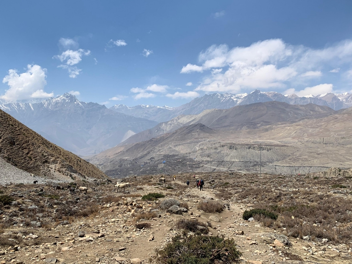
Section C: Phedi to Muktinath:Final walk of the 7th day from Phedi to Muktinath covers about 5 km and takes around 2 to 3 hours. path here is a mix of flat sections and a gradual downhill trek where you can enjoy the breathtaking mountain views of Dhaulagiri and Tilicho peak. The trail on this Annapurna Circuit Trekking Route is dry and rocky with a desert feel like environment that is common in the Mustang region. You may see herds of horses as you follow the clear valley trail toward the sacred site. Muktinath is located at 3,760 m and marks a major milestone after crossing the high pass. Trekkers can see the famous 108 water spouts and many pilgrims performing rituals. The town has simple lodges and guesthouses for you to rest. Reaching this Hindu and Buddhist spiritual site provides a sense of peace and achievement on Annapurna Circuit Trek journey.
Day 8: Drive from Muktinath to Tatopani via Jomsom and Marpha
Today we will take a drive from Muktinath to Tatopani covering roughly about 70 km. The journey takes about 5 hours in a tourist jeep or bus. We start in the dry high valley of Muktinath and descend into the Kali Gandaki gorge towards Tatopani. The road from Muktinath to Ghasa is paved while the section from Ghasa to Tatopani is about 60 percent paved. First, we will reach Jomsom which serves as the district headquarters of Mustang. This bustling town acts as a transport hub with banks and shops at 2,720 m.
drive continues to Marpha which is a picturesque Thakali village. Marpha village (2,670 m) is famous for its apple orchards and the local apple brands. Trekkers here can witness traditional stone houses and narrow lanes where locals’ dry apples on rooftops and sells different apple products. After spending some time at Marpha the road drops to Tatopani at 1,190 m. The name means hot water in Nepali because the village has many natural hot springs. Trekkers soak in these springs to relax their sore muscles after the long and tiring journey. This riverside settlement offers a warm climate and a peaceful vibe to end your day before we begin our next part of the journey.
Day 9: Trek from Tatopani to Ghorepani
After spending a relaxed night at Tatopani, we will start today’s Annapurna Circuit Trekking journey early in the morning. The trek from Tatopani (1,190 m) to Ghorepani (2,880 m) covers about 15 km and takes 7-8 hours. On today’s Annapurna Circuit Trek with Ghorepani Poon hill trekking journey you gain altitude of 1,700 m in altitude as we climb from the Kali Gandaki River gorge to mountain ridge. This well marked stone paths lead us to Ghorepani village through traditional Gurung villages and green valleys passing through lush rhododendron and oak forests.
Section A: Tatopani to Ghara:The trek from Tatopani to Ghara covers about 5 km and takes roughly 1.5 to 2 hours. You walk on a paved road until you reach a suspension bridge. After you cross the bridge, you need to take an acute uphill climb to Ghara village at 1,700 m. The path consists of clear stone steps and gravel paths along the valley. During the journey enjoy views of the Kali Gandaki gorge and river as you climb. This section offers your first look at traditional stone villages and terraced fields in this region.
Section B: Ghara to Shikha:This section of Annapurna Circuit Trek with Ghorepani Poon hill, the trek from Ghara to Shikha covers 3 km and takes roughly around 2.5 hours. Trekkers gain altitude from 1,700m from Ghara to roughly 1,935 m at Shikha. The trail continues through open agricultural slopes and small fields with scattered houses. As you get closer to Shikha you enter a denser forest the path gets narrow and occasionally uneven. This climb is steady and easy for the most part with some uphill sections too as there are no cliffs or dangerous areas. Shikha village is a traditional settlement that is set on a ridge.
Section C: Shikha to Chitre:Section of walking covers about 4 km and takes 1-1.5 hours where trekkers follow a gradual uphill trail and climb from Shikha (1,935 m) to Chitre at around 2,390 meters. The path leaves Shikha and follows a ridge through mixed forest and open slopes. Here, you enjoy more shade and forest cover which makes the climb more comfortable. On clearer days, trekkers can witness the Dhaulagiri Massif and the Annapurna range.
Section D: Chitre to Ghorepani:Trek from Chitre to Ghorepani covers about 2-3 km and takes roughly 1-2 hours of steady walking. The trail consists of uphill stone stairs that lead you through dense rhododendron and oak forests. In the spring season the rhododendron bloom makes the path very scenic though the long climb can feel tiring. As you get closer to Ghorepani the path softens into a village lane with small lodges and side alleys. Trekkers will see many small teahouses and the start of the famous Poon Hill trail. On clear days the ridge offers glimpses of Annapurna South, Machhapuchhre and Hiunchuli and more. You can also see the peak of Machhapuchhre from this area. Reaching the main street of Ghorepani, it marks the end of a long day of climbing on Annapurna Circuit Trek with Ghorepani Poon Hill. This village serves as a major rest point before the morning hike to the viewpoint.
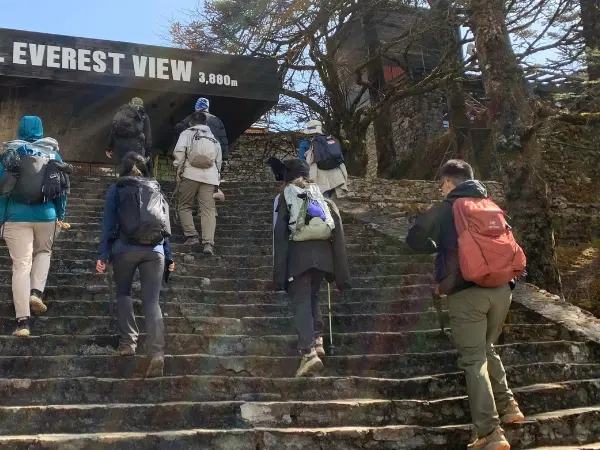
Day 10: Ghorepani to Poon Hill and Drive to Pokhara
Day 10 features a short iconic morning trek to Poon Hill followed by a long drive back to Pokhara. The main focus is the sunrise at Poon Hill Viewpoint. We start the day early around 5 AM to reach the viewpoint for the breathtaking sunrise over Himalayas. After enjoying the magical sunrise, we trek downhill to Banthanti and drive to Pokhara. And finally, we will officially complete the Annapurna Circuit Trek with Ghorepani Poon hill journey in Pokhara by evening.
Section A: Ghorepani to Poon Hill and Back to Ghorepani:Round trip from Ghorepani to Poon Hill covers about 3 km and takes roughly 2 hours. You climb from 2,880 m to the viewpoint at 3,193 m using a steep stone-step trail. This path climbs straight through lush rhododendron forest. This is one of the most famous viewpoints in Nepal and offers 360-degree sunrise view of Annapurna and Dhaulagiri ranges including Machhapuchhre and Nilgiri. This is one of the most famous viewpoints in Nepal. Most of the trekkers return to Ghorepani for a warm breakfast and rest for a while before they continue the journey downhill to Banthanti.
Section B: Ghorepani to Banthanti:Trek from Ghorepani to Banthanti covers about 6 km and takes around 3-4 hours. You descend from 2,880 m to roughly 2,210 m which means you lose about 660 m in elevation. The natural trail is mostly descending and follows a ridge through a lush rhododendron and oak forest. As you get closer to Banthanti the path opens into agricultural slopes and green hills. This downhill walk is easier on the lungs but can be tiring for knee. Trekkers can enjoy final views of the Annapurna and Dhaulagiri ranges along the ridge. Banthanti is a small hillside settlement with a few lodges where you take a rest and prepare for the drive back to Pokhara.
Section C: Drive from Banthanti to Pokhara:From Banthanti, our trekking journey of Annapurna Circuit Trek with Ghorepani Poon hill officially completes. From here, we will take a jeep ride back to Pokhara. The drive from Banthanti to Pokhara is roughly 70 km and takes about 3-4 hours in jeep. From here we leave the high hills and follow the road down towards Pokhara city. The route is off road until we reach Birethanti. However, from Birethanti (1,025 m) to Pokhara (820 m), the road is fully paved, which makes the journey really relaxing. The drive offers views of rivers and terraced hillsides along the way. After arriving in Pokhara, city offers a comfortable hotel where trekkers can take a full night rest after spending days in high mountains. In the evening, trekkers can enjoy tasty meals while celebrating with fellow trekkers upon successful completion of Annapurna Circuit Trek with Ghorepani Poon Hill.
Day: 11 Pokhara to Kathmandu (Drive / Flight)
On the last day of our Annapurna Circuit Trekking journey, travelers drive from Pokhara to Kathmandu, by following the Prithivi Highway which is about 200 km. The road journey usually takes about 6 to 8 hours depending upon traffic and road conditions. The route passes through river valleys and small roadside towns which offers scenic views for one last time. As you approach towards Kathmandu, the rural hills change into busy city roads. This drive allows you to see the local markets along the roadside before we reach to hotel in Thamel.
However, a flight is the fastest way to return to Kathmandu to Pokhara. The flight takes around 30 minutes and this option saves you a full day of driving while helping you to avoid highway traffic. On clear days, the flight offers beautiful aerial views of the Himalayan peaks. While the airport process is simple, trekkers should prepare for the possible weather delays. Choosing flight option is ideal for you if you have a tight international schedule or prefer a comfortable journey.
Final Words
The Annapurna Circuit trek offers a journey that stays with you long after you return home. Crossing the Thorong La Pass and walking through the diverse landscapes of Mustang creates a lifelong memory. Trekkers can witness the large scale of the Himalayas and the strength of the local people who live here. This Annapurna Circuit Trekking challenges your physical limits and rewards you with the deep sense of achievement and satisfaction. Each step on Annapurna Circuit Trekking Route from the lush forests to the high-altitude deserts provides you a new perspective on the natural world. You leave the mountains with a quiet mind and a stronger spirit.
bond you form with the mountains and your fellow trekkers is the most important highlight of Annapurna Circuit Trek with Ghorepani Poon hill adventure. While peaceful nights in traditional tea houses and sharing stories by the fire with local people builds a special connection to the Nepalese Himalayan culture. Trekkers witness the magical sunrise over massive peaks on different viewpoints like Poon Hill and walk through the centuries old monasteries like Braga monastery. These experiences really change how you view your own daily life and the world around you. The Annapurna Circuit is more than just a random hike because it is a test of real character, endurance and a lesson in patience. With Mount Face Nepal, your trekking journey remains safe, enjoyable and successful with our reliable services and experienced guides.