The Pikey Peak Trek is an 8-day journey through the lower Solu region of Nepal, covering roughly 60-70 Km of walking distance at a relaxed pace. It takes you to Pikey Peak at 4,065 m, that offers one of the best panoramic views of Everest, Kanchenjunga, Makalu and the surrounding Himalayan range without the crowds or altitude risks of higher treks. The route winds through Sherpa villages, rhododendron forests, and open ridgelines, giving you a genuine taste of rural Nepal away from the busy Everest corridor.
The Pikey Peak Trekking trail conditions are mostly moderate, with well-maintained paths through forests, stone steps and gentle climbs which don’t demand technical skills or extreme fitness. Most days involve 4-6 hours of walking, with plenty of time for rest, exploring the villages while soaking in the scenery. Since the highest point is only at 4,065 meters, altitude sickness risk is far less compared to treks like Everest Base Camp, Gokyo Lake or Three Passes Trek. This makes Pikey Peak Trekking route a solid choice of beginners and those who are short on time.
Face Nepal handles every detail regarding the trek, from permits and accommodation to meals and guides, so you can just focus entirely on the experience. Our sherpa guides have local knowledge of the Solu region which means you will get insider access to the best viewpoints, quiet guesthouses, and an authentic Sherpa culture along the way. Whether you are a first-time trekker or someone looking for a shorter Himalayan escape, we make your Pikey Peak journey much smoother, safer, and genuinely memorable from start to finish.
Quick Facts: Pikey Peak Trekking Route
| Details | Pikey peak |
| Location | Lower Everest / Solu-Khumbu region, Nepal. |
| Duration | 8 days (including arrival, drive days, and departure). |
| Maximum Altitude | 4,065 m (13,336 ft) at Pikey Peak summit. |
| Trek Distance | 55–75 km, depending on route and side trips. |
| Trekking Distance | 5 days (Dhap → Jhapre → Pikey Base → Junbesi → Salleri) |
| Maximum Altitude | 4,065 m (13,336 ft) at Pikey Peak summit. |
| Starting / Ending Point | Kathmandu → Dhap (start) / Salleri → Kathmandu (end) |
| Difficulty | Moderate, suitable for beginners with reasonable fitness. |
| Daily Walking | 4–7 hours per day on gradual trails. |
| Best Seasons | Spring (Mar-May) and Autumn (Sep-Nov) |
| Key Highlights | Sunrise views of Everest, Lhotse, Makalu, Kanchenjunga, Thubten Choling Monastery, Sherpa villages of Jhapre and Junbesi. |
Understanding the Pikey Peak Trek Map
Section 1: Kathmandu to Jhapre via Dhap
The trip begins with a long drive from Kathmandu to Dhap, winding through rolling hills and small towns before you reach the trailhead. From Dhap the walking starts with quiet forest and open ridgelines that leads us to Jhapre. It is small Sherpa village with a lovely old monastery. This first stretch is easy and scenic, a gentle way to settle into the trek and get your first real feel for the Solu countryside.
Section 2: Jhapre to Pikey Peak Summit and Descent to Junbesi
From Jhapre the trail climbs steadily through rhododendron forest toward Pikey Peak Base Camp, where you spend the night before an early start for the summit. The climb to the top (4,065 m) is the major highlight of the whole trek, which opens up a huge panorama of Everest, Kanchenjunga, Makalu and dozens of other peaks. After taking in the views you drop down toward Junbesi, a beautiful Sherpa village set in a green valley.
Section 3: Junbesi to Phaplu via Thuten Choling
Leaving Junbesi, the path heads toward Thuptenchholing Monastery, one of the most important Buddhist sites in the area, tucked among quiet forest and mountain views. From there the Pikey Peak trail winds down through villages and terraced fields all the way to Phaplu, where the trek ends. This last stretch is relaxed and scenic, giving you a chance to look back on the journey before the road or short flight back to Kathmandu.
Section 4: Drive back to Kathmandu
Once the trek ends in Salleri or Phaplu, the return journey to Kathmandu starts with a long but scenic drive through the Solu hills and down toward the Terai plains. The road passes small towns, rivers and terraced farmland, giving you a final look at rural Nepal before the city comes back into view. It’s a full day on the road, but an easy one. By evening you’re back in Kathmandu, where Pikey Peak trek concludes successfully, with a solid sense of achievement and a camera full of mountain shots.
Complete Pikey Peak Trek Itinerary: Day-by-Day Trekking Route, Highlights & Travel Guide
Day 01: Arrival in Kathmandu (1,400 m)
Distance: 6 km (Airport Transfer) | Duration: 30–45 minutes | Terrain: Urban asphalt roads, bustling city traffic
Section 1: Airport to Thamel: Travelers Himalayan journey begins as the flight descends over the Kathmandu Valley, showing green hill ridges framed by distant snow-capped peaks. After you land at Tribhuvan International Airport (1,400 m), complete immigration, collect luggage, our Mount Face Nepal team will welcome you. Our private vehicle drives you through city streets toward Thamel, covering 6 km in about 30 minutes. The drive passes colorful local buses, motorbikes, fruit vendors, and historical street markets before turning into the narrower cobblestone streets of the tourist hub.
Section 2: Hotel Check in and Rest: We arrive at the hotel in Thamel, check in, unwind from the long international flight, and freshen up. The afternoon is free to rest and adjust to the city atmosphere. Thamel is filled with the outdoor gear shops, organic bakeries, handicraft stalls, and cafes, which gives us a first feel of the trekker’s hub in Nepal.
Section 3: Evening Trekking Briefing and Preparation:In the late afternoon you will meet our lead Himalayan guide for the official trekking briefing. Together we review the day-by-day Pikey Peak Trek itinerary, and inspect gear requirements. If we need extra items such as trekking poles, a down jacket, or microspikes, the guide will help you with rentals or purchases in nearby shops. Also at the hotel, we will organize our duffel bags, leave unnecessary luggage in hotel storage, and rest early for the pre-dawn drive eastward into the lower Everest region.
Day 02: Drive from Kathmandu (1,400 m) to Dhap (2,932 m)
Distance: 230 km | Duration: 7–8 hours | Terrain: Paved highway blacktop, winding hill curves, single-lane dirt and gravel tracks
Section 1: Kathmandu (1,400 m) to Dhulikhel (1,550 m): We leave Kathmandu early, around 5:30 AM, in a 4WD jeep or private vehicle and cover the 30 km east in about 1-1.5 hour. The road climbs steadily out of the valley basin toward the rim, with smooth blacktop, and you start getting the first open views of the surrounding hills as we pass through Dhulikhel.
Section 2: Dhulikhel (1,550 m) to Khurkot (388 m): From Dhulikhel we will continue on the BP Highway for another 80–90 km, roughly 2.5 to 3 hours, dropping down into the Sun Koshi River valley. The road follows the river’s bends past terraced farmland, bamboo stands and a string of small roadside trading spots. At Khurkot we cross a concrete bridge over the turquoise Sun Koshi and join the Mid-Hill Highway (Pushpal Lal Lokmarg).
Section 3: Khurkot (388 m) to Ghurmi (424 m): From Khurkot it’s another 50–60 km through the green hills of Okhaldhunga district, taking about an hour and a half to two hours. The road narrows to a single-lane mountain track with tight switchbacks, occasional roadworks and big views into the river gorges. Around midday we will stop near Ghurmi or Harkapur for a hot lunch of fresh dal bhat or fried noodles. As we push further east the surface begins to change toward unpaved sections.
Section 4: Final Climb to Dhap (2,900 m):The last 50–60 km take about 2–2.5 hours into Solukhumbu district. The road shifts fully to dirt and packed gravel as the jeep navigates hillside cutouts, pine forests, and small Tamang and Sherpa hamlets. Our vehicle will climb through dense oak and rhododendron woodlands, crossing rural high passes before reaching the ridge-top settlement of Dhap (2,932 m). We will arrive by late afternoon, check into a local stone teahouse on the ridge, and enjoy broad views of rolling hills and on a clear day, the first distant glimpse of the Everest massif. After the long drive we will drink hot lemon-ginger tea, share a warm meal by the dining stove, and rest in the quiet mountain air. Overnight at Dhap.
Day 03: Trek Dhap (2,900 m) to Jhapre (2,820 m)
Distance: 13-14 km | Duration: 4–5 hours | Terrain: Wide dirt ridgeline tracks, open pine/rhododendron forest paths, gentle stone steps
Section 1: Dhap (2,900 m) to Forest Ridge: We will leave Dhap after breakfast and cover about 3–4 km in 1–1.5 hours along a scenic ridgeline trail. The path starts on a wide unpaved mountain track that follows the spine of the ridge, giving clear views on both sides into deep terraced valleys below. The walking is comfortable on firm packed dirt, small pebbles, and gentle stone steps.
Section 2: Forest Ridge to Sigane (2,800 m): We continue about 3–4 km in 1–1.5 hours as the trail enters a peaceful forest of blue pine, fir, and giant rhododendron trees. In spring these woodlands fill with red, pink, and white blossoms. The quiet path steps past traditional stone enclosures where local herders keep cattle and yaks, and the air smells of pine trees. After roughly one and half hour of gentle trekking we reach Sigane (2,910 m), a small hamlet on an open clearing. We will take pause and little rest on a local tea shop. From here, the views open wide and on a clear morning, the white snow wall of Numbur Himal (6,958 m), the sacred peak of Solukhumbu dominates the northern horizon along the distant Rolwaling range.
Section 3: Sigane (2,800 m) to Mani Walls: From Sigane, we will walk about 3 Km in 1 hour along a gentle incline that alternates between open dirt tracks and stone-paved forest paths. Along the way, we will pass several long mani walls covered with hand-carved Tibetan prayer stone slabs. And always walk to the left side of these sacred structures, as it shows respect.
Section 4: Mani Walls to Jhapre (2,820 m): The final 3–4 km of this Pikey Peak Trek route section takes 1–1.5 hours and bring us to the picturesque Sherpa village of Jhapre (2,820 m). It sits on a dramatic grassy shelf overlooking the valley and features a historic monastery (Jhapre Gompa) beside a row of colorful stupas and prayer wheels. We check into the teahouse, explore the monastery, interact with local villagers and watch the evening light illuminating Numbur Himal.
Day: 04 Trek from Jhapre (2,820 m) to Pikey Peak Base Camp (3,640 m)
Distance: 15 km | Duration: 5–6 hours | Terrain: Alpine ridge trails, stone staircases, dense rhododendron/fir woods, high tundra pastures
Section 1: Jhapre (2,820 m) to Bhulbhule (3,175 m): We leave Jhapre and cover about 4-5 Km 1.5 – 2 hours, ascending steadily along the crest of a high ridge into an increasingly alpine environment. The morning walk starts on a stone paved trail that climbs through ancient moss draped forests of oak, fir, and dwarf rhododendron. As we gain elevation past 3,000 meters the trees become shorter and thinner, giving way to open alpine meadows grazed by yak herds in summer. After about two hours of continuous uphill hiking we reach Bhulbhule (3,350 m) which is lone settlement with a couple of basic tea shops. Here, we will pause for tea and take in views of the lower valleys often filled with a sea of morning clouds.
Section 2: Bhulbhule (3,175 m) to Lhamuje (3,500 m): From Bhulbhule, we will climb about 3-4 km in 1-1.5 hours up on a long flight of stone stairs leading toward Lhamuje. The path on this part of Pikey Peak Trek route is high cliff contours, stepping across open turf and exposed granite. We pass Lhamuje (3,500 m) as the terrain shifts into pure high altitude mountain meadow.
Section 3: Lhamuje (3,500 m) to Yak Kharka (3,580 m): From Lhamuje, we will walk about 3-4 km in 1-1.5 hours through terrain dominated by dwarf junipers, alpine scrub and wide rock fields. The trail then follows a well-defined single-track dirt path that contours smoothly around the high flanks of Taklung ridge. We will also pass several traditional yak pastures with frequent stone walls while listening to the rhythmic climbing bells from grazing yaks.
Section 4: Yak Kharka (3,580 m) to Pikey Peak Base Camp (3,640 m): The final 3-4 Km take 1-1.5 hrs as the path crosses small frozen streams and climbs a gentle incline across a wide wind-blown gravel basin. The towering double peaked ridge of a Pikey peak rises dramatically above the valley floor. By late afternoon, we will arrive at Pikey Peak Base Camp (3,640 m). Pikey Peak Base Camp is a small cluster of stone teahouses nestled in the mountain basin beneath the peak. The air is cold, crisp and thin.
Here, we will settle into the cozy lodge, gather in the dining hall for a hot meal of soup and dal bhat. Please double check your headlamp batteries and down layers. Also, we will get an early sleep, because tomorrow we will start before dawn to reach summit for magical sunrise.
Day 05: Pikey Base Camp (3,640 m) to Pikey Peak Summit (4,065 m) to Junbesi (2,700 m)
Distance: 14 km | Duration: 6–7 hours | Terrain: Steep grassy/rocky summit path, exposed alpine ridge, continuous steep forest descent, stone staircases
Section 1: Pikey Base Camp (3,640 m) to Pikey Peak Summit (4,065 m): We start before dawn around 4:30 AM from Base Camp (3,640 m) with headlamps and full winter layers. The climb covers about 2–3 km and takes roughly 1.5 hours of steady slow pacing to reach the Pikey Peak Summit. The trail ascends steeply over grassy slopes, loose scree, and granite boulders, gaining 420 vertical meters.
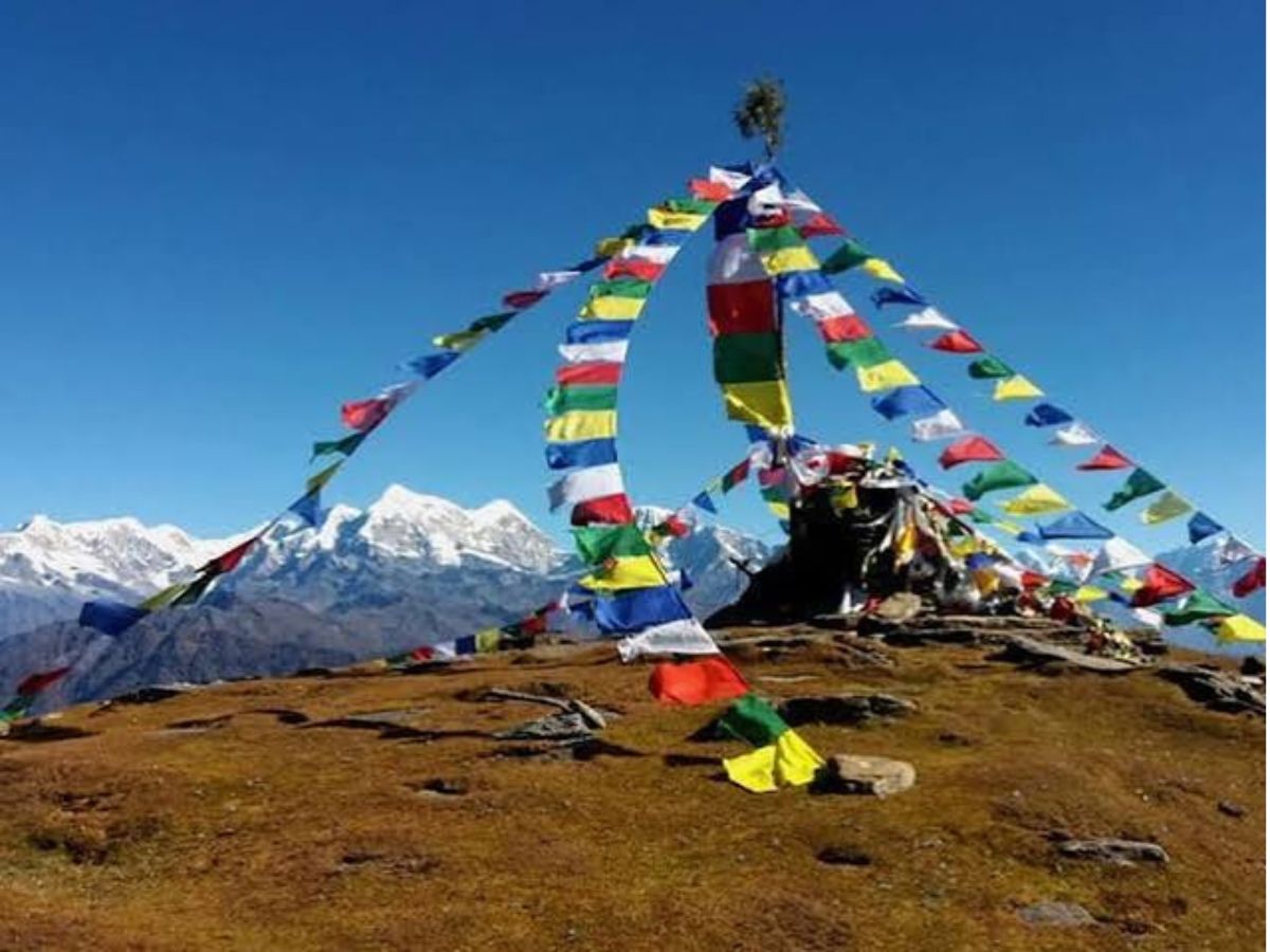
Near the top cold high-altitude winds blow across the exposed ridge, but the pre-dawn glow over the Himalayas keeps our momentum high. We reach the summit of Pikey Peak (4,065 m), that is marked by prayer flags and a prominent chorten.
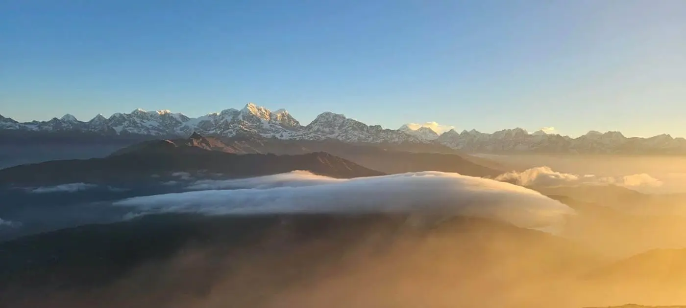
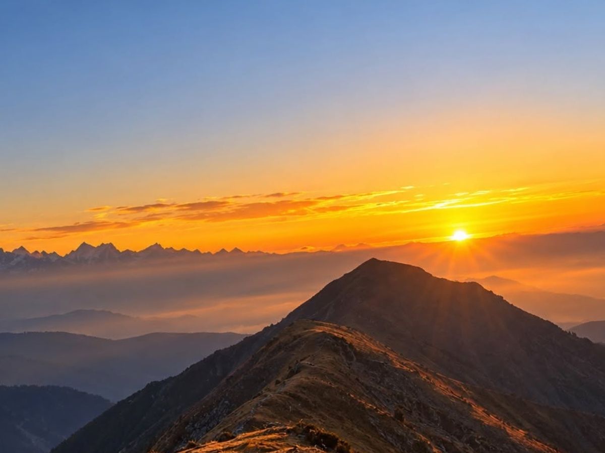
Section 2: Pikey Peak Summit Views: Standing on the summit, we are rewarded with one of the greatest mountain views in Nepal, which was praised by Sir Edmund Hillary himself. As the sun rises, a 360-degree panorama lights up the horizon, showing eight 8,000-meter peaks: Mount Everest (world’s highest), Lhotse, Makalu, Kanchenjunga, Cho Oyu, Manaslu, Annapurna I, and Dhaulagiri, along with Numbur Himal and Thamserku. The endless sea of lower green hills and white giant peaks is deeply awe inspiring. We absorb the sunrise, take milestone photos and enjoy a warm drink from a thermos before starting the descent.
Section 3: Pikey Peak (4,065 m) to Jasmane Bhanjyang (3,520 m): From the summit, we will descend about 3-4 km in 1.5-2 hours down the eastern ridge toward Jasmane Bhanjyang (3,550 m). The downhill path follows a grassy stone track that drops steeply through alpine meadows before entering dense rhododendron and pine forests. You need to be careful on these sections of Pikey Peak Trekking route because of loose soil and damp tree roots. After reaching Jasmane Bhanjyang, we will take a tea or lunch break.
Section 4: Jasmane Bhanjyang (3,520 m) to Junbesi (2,700 m): From Jasmane Bhanjyang the final 6-7 km takes 2.5-3 hours on a sustained descent through thick pine, oak, and bamboo forests. The trekking path on this Pikey Peak Trek map consists of a long series of hand cut stone staircases that wind through shady canyons and cross small wooden bridges over rushing glacial streams. As we drop the elevation quickly, the air grows warmer and richer in oxygen. By late afternoon, the dense forest opens into a fertile green valley that is filled with terraced fields of barley, wheat and potatoes.
After a while, we will step into a large prayer wheel that is turned by mountain streams and walk into the beautiful Sherpa village of Junbesi (2,700 m). Junbesi features traditional whitewashed stone houses, wooden carved balconies and the historic Junbesi Monastery. We will check into a comfortable lodge, take a hot shower and enjoy a peaceful evening exploring the village.
Day 06: Exploration Day: Hike to Thubten Choling Monastery (3,000 m) & Return
Distance: 10 km (Round Trip) | Duration: 4–5 hours | Terrain: Stone-paved valley pathways, riverside forest trails, gentle hill switchbacks
Section 1: Junbesi (2,700 m) to Thubten Choling Monastery (3,000 m): After having a relaxing breakfast, we will leave Junbesi and cover about 5 Km in 2-2.5 hours heading north along the Junbesi Khola river valley. The walk starts on a stone paved pathways through the village before becoming a scenic dirt trail that follows the crystal-clear river. The terrain is gentle over river stones, wooden bridges, and pine trees covered paths. Along the way, we pass different small traditional hamlet and ancient mani walls carved with Buddhist mantras. We will cross the Junbesi Khola on a steel suspension bridge decorated with prayer flags and climb a short series of gentle stone switchbacks up the eastern hillside to reach Thubten Choling Monastery.
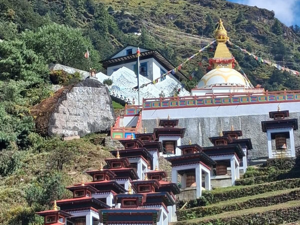
Section 2: Exploration of Thubten Choling Monastery (3,000 m): Thubten Choling Monastery (3,000 m) was founded in 1960s by the Tibetan Buddhist master Kyabje Trulshik Rinpoche. Thubten Choling Monastery (3,000 m) was founded in 1960s by the Tibetan Buddhist master Trulshik Rinpoche. It’s a large complex that houses hundreds of monks and nuns, with a grand assembly hall, rows of whitewashed stupas and colorful prayer flags set against the mountain backdrop. Inside the main shrine hall you can hear the monks chanting, spinning prayer wheels and sounding the long traditional horns. Visitors are welcome to sit quietly and watch the afternoon prayers, witness the large gold Buddha statues and detailed wall murals, and sometimes receive a blessing.
Section 3: Thubten Choling Monastery (3,000 m) to Junbesi (2,700 m): After exploring the monastery, we will begin the return journey towards Junbesi, covering 5 km in under 1.5 hours. We will follow the same scenic river path we used earlier. After arriving back at Junbesi by Mid afternoon, we will have free time to visit the local apple farms, relax at bakery, or enjoy a quiet evening at teahouse.
Day 07: Trek Junbesi (2,700 m) to Salleri (2,360 m)
Distance: 16 km | Duration: 5–6 hours | Terrain: Stone pathways, gentle forest trails, suspension bridges, dirt roads, agricultural valley tracks
Section 1: Junbesi (2,700 m) to Salung (2,845 m): We will leave Junbesi after breakfast and cover about 4 km in 1–1.5 hours heading east. The Pikey Peak trail exits the village on a wide stone-paved path, crosses the Junbesi Khola over a wooden bridge, and climbs a gentle forest slope toward Salung. The path is firm soil, tree roots, and stone steps running through pleasant pine and oak woods. At the ridge hamlet of Salung (2,830 m) we enjoy a final panoramic view looking back across the valley toward Pikey Peak and the distant peaks of Everest and Numbur Himal. We will pause at a trailside tea stall for a quick break while enjoying the views.
Section 2: Salung (2,845 m) to Ringmo (2,800 m): Salung we will descend about 4–5 km in 1.5–2 hours through terraced fields toward the Ringmo Khola valley. The trail passes small agricultural settlements like Ringmo, known for its apple orchards, apple pies, and fruit wines. We cross the fast-flowing Ringmo Khola on a high steel suspension bridge to reach the Ringmo village.
Section 3: Ringmo (2,800 m) to Trakshindo La (3,070 m): After crossing the bridge, we will climb about 2–3 km in 30–45 minutes up to Trakshindo La Pass (3,070 m). The pass features a large white chorten and the historic Trakshindo Gompa monastery overlooking the deep Dudh Koshi valley floor ahead. From here, travelers can get sweeping views of Mount Everest, as well as Lhotse, Nuptse, Makalu, Thamserku, and Mera Peak.
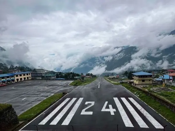
Section 4: Trakshindo La (3,070 m) La to Salleri/Phaplu (2,360 m): Trakshindo La, the final 5–6 km takes 2–2.5 hours on a downhill mix of stone staircases, forest dirt paths, and unpaved rural tracks across terraced farmlands. By late afternoon the foot trail merges into a paved road leading into the bustling town of Salleri (2,360 m) and nearby Phaplu. Salleri is the administrative center of Solukhumbu district with paved streets, local markets, government offices, and a nearby airstrip. We check into a comfortable hotel, celebrate the successful completion of the trek with our guide and porter crew, and enjoy a warm dinner.
Day 08: Drive Salleri (2,360 m) to Kathmandu (1,400 m)
Distance: 265 km | Duration: 8–9 hours | Terrain: Unpaved dirt mountain tracks, paved mid-hill highway, urban asphalt roads
Section 1: Salleri (2,360 m) to Solu Khola (1,824 m): We leave Salleri early, around 6:00 AM, in a private 4WD jeep and cover the 40–50 km to Solu Khola in about 1.5 to 2 hours. The road out of town is a winding dirt-and-gravel track that drops through the lower hills of Solukhumbu. The first stretch passes through lush sub-tropical forest, terraced rice fields and a few small trading villages before we cross the Solu Khola on a motor bridge.
Section 2: Solu Khola (1,824 m) to Harkapur (375 m): From the bridge we will continue about 60–70 km in 2–2.5 hours, climbing over scenic green hill passes before connecting to the main Mid-Hill Highway (Pushpal Lal Lokmarg) near Harkapur. The road condition improves here as we reach paved asphalt that follows the Sun Koshi River through the rolling hills of Okhaldhunga district.
Section 3: Harkapur (375 m) to Dhulikhel (1,550 m): We drive about 80–90 km in 2.5–3 hours west through Okhaldhunga and Sindhulpalchok districts. Around midday we will stop at a highway restaurant along the Sun Koshi River for a hot lunch of traditional dal bhat or noodles and watch green waters below. The highway then follows the BP Koirala Highway, climbing steep switchbacks toward the Kathmandu Valley via Dhulikhel.
Section 4: Dhulikhel (1,550 m) to Kathmandu (1,400 m): Final 50–60 km take about 1.5–2 hours to reach Kathmandu. The road becomes a wide multi-lane paved highway passing through the historic towns of Banepa and Bhaktapur. Heavy urban traffic, motorbikes, and colorful local buses signal our approach to the capital. The cooler mountain air of Solukhumbu gives way to the warm bustling environment of the Kathmandu basin. By late afternoon or early evening, we will arrive at our hotel in Thamel. Here, we check in, take a long hot shower, drop off trekking gear, explore the Thamel’s markets. At evening, travelers can enjoy a farewell dinner with trekking guides and fellow, reflecting on the journey to the summit of Pikey Peak.
Best Time for Pikey peak Trek
The best time to do the Pikey Peak Trek is during autumn and spring. Autumn from September to November, brings crisp and clear weather. Trails are dry and safe, and you get unobstructed views of Everest, Kanchenjunga, and Dhaulagiri. October and November (Spring) also bring festivals like Dashain and Tihar, so you get a nice dose of local culture along with the trekking.
Spring, from March to May, is another solid window as days are warm, rhododendron forests are in full bloom, and mornings are usually clear. Winter is doable too since the peak only sits at 4,068 m, giving you quiet trails and sharp views, but you’ll need proper thermal layers for the freezing nights. Monsoon, from June to August is not recommended for Pikey Peak trek because of rain, mud, leeches, and cloud cover, as it makes the trek far less enjoyable.
Is Pikey Peak Trek route Suitable for beginners?
Yes, the Pikey Peak Trek difficulty is considered moderate, so it is a really great choice for beginners. The Pikey Peak Trek from Kathmandu trail stays below 4,065 m, so altitude sickness is much less of a worry compared to the higher treks like Everest Base Camp. Most days involve just four to six hours of walking on clear and well-marked paths through forest and villages, with nothing technical and no glacier crossings. It’s a gentle way to join into Himalayan trekking while still giving you those big mountain views.
Travelling with experienced guides from Mount Face Nepal makes it even safer and more relaxed. They look after the route, the pace and the day-to-day details so you can simply walk and enjoy the scenery. The Pikey Peak Trek itinerary is built for enough rest and keeps the climbs gradual, so first-time trekkers can finish the trip without feeling rushed or pushed too hard. So, it's a solid choice for anyone looking for their first proper Himalayan adventure.
What are the required permits for Pikey Peak Trek?
For the Pikey Peak Trek you’ll need a few permits: the Sagarmatha National Park Entry Permit (NPR 3,000), the Gaurishankar Conservation Area Permit (NPR 3,000), and a TIMS card (USD 20). Depending on your exact route, a Local Area Permit (NPR 2,000) may also be required if the trek passes through certain municipality areas. These permits will let you walk through the villages, forests, and hills of the Solukhumbu region legally and safely.
However, you don’t need to worry about sorting any of this permit yourself because Mount Face Nepal takes care of all the permits before your journey begins, as part of the Pikey Peak Trek package. That means you can just show up ready to trek without worrying about paperwork, queues, or extra costs popping up along the way. Everything is sorted in advance so you can just keep your focus on the trail and the views instead of the logistics.
What Mountain Views can be seen along the Pikey Peak Trekking trail?
The mountain views from Pikey Peak are the real reason people come, and Sir Edmund Hillary himself once called it one of his favorite viewpoints for seeing Everest. From the summit at 4,065 m, travelers can get a sweeping panorama that stretches from Dhaulagiri in the west all the way to Kanchenjunga in the east on a clear day. You can spot Everest (8,848 m), Kanchenjunga (8,586 m), Lhotse (8,516 m), Makalu (8,485 m), Cho Oyu (8,201 m), Manaslu (8,163 m), and even Annapurna and Dhaulagiri on the clearest mornings.
Beyond the eight-thousanders, the trail also gives you close-up views of Ama Dablam, Nuptse, Thamserku, Mera Peak, Gaurishankar, Numbur Himal, Khatang, and Karyalung. The best moments are sunrise and sunset from the summit or viewpoints like Bhulbhule, when golden and red light washes over the snow-capped wall of the Himalayas in magical way. It’s the kind of view that makes the early morning wake-up and the climb completely worth it, and it stays with you long after the completion of Pikey Peak Trek.
Culture and Local Insights along the Pikey peak Trekking Route
The Pikey Peak Trek route winds through traditional Sherpa villages where life still moves at a quieter and simpler pace. Along the way trekkers pass mani walls, strings of colourful prayer flags and small monasteries that show how deeply Buddhism is woven into everyday life here. The people are genuinely warm and welcoming, so it doesn’t take long before the place starts to feel truly familiar. Spending time in these communities gives you a real sense of Sherpa customs, daily routines and the warm hospitality that defines the region.
Final Words
The Pikey Peak Trek route is one of those rare routes that gives you big Himalayan views without the crowds, altitude risks, or long commitment of the bigger treks. In just 8 days, you get to stand on a summit that Sir Edmund Hillary himself praised. Walk through the quiet Sherpa villages, and see Everest, Kanchenjunga, and Makalu all in one sweeping panorama. It’s a trek that feels deeply personal, peaceful, and genuinely rewarding from start to finish.
you’re a first-time trekker or someone looking for a shorter Himalayan escape, this route delivers more than you would expect. The trails are really manageable, the culture is rich, and the views are truly unforgettable. With Mount Face Nepal handling the all permits, logistics, and local guidance, your journey really stays safe, smooth, and fully enjoyable, leaving you free to simply walk, take it all in, and make memories that last well beyond the trail.