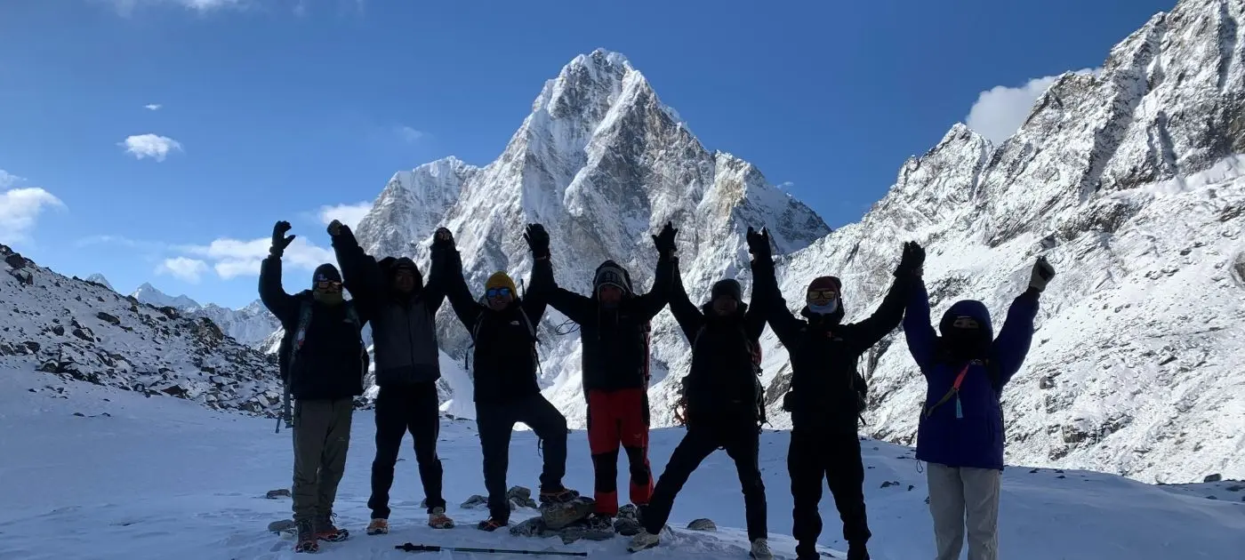
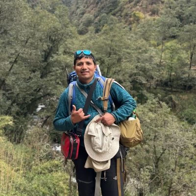
The Everest High Passes Trek is a demanding 19-to-21-day high-altitude circuit in the Khumbu region that crosses three legendary mountain passes exceeding 5,300 meters. Everest Three Passes Trek is not just a trek to Everest Base Camp, it’s a full loop through the major valleys of Thame, Gokyo, Khumbu, and Chhukung, weaving between glaciers, turquoise lakes, and some of the world’s highest peaks. You can go clockwise or anti-clockwise, but either way, you are joining up for one of the most complete and challenging Everest experiences available.
Everest High Pass Trekking Route passes on three big passes: Renjo La Pass (5,360 m), overlooking the Gokyo Lakes, Cho La Pass(5,420 m), which crosses a glacier between Everest Base Camp and the Gokyo Valley and Kongma La (5,535 m), the highest and most physically demanding, linking Chhukung and Lobuche. Along the way, you’ll hit iconic landmarks like Everest Base Camp, Kala Patthar, Gokyo Ri, and Tengboche Monastery, with panoramic views of Everest, Lhotse, Makalu, Cho Oyu, and Ama Dablam. Total distance runs about 166 km over 19–21 days, starting and ending in Lukla after a short flight from Kathmandu.
at Mount Face Nepal have good experience with this trek and our experienced sherpa guides know where the glacier gets tricky, and how to time your pass crossings for the best weather and fewest crowds. We handle all required permits Everest Three Passes Trekking Route, arrange the best flights to Lukla, and pair you with an experienced sherpa guides who have grown up in the Khumbu and understand the rhythm of high-altitude trekking. With Mount Face Nepal, you are not just checking off passes, you are also moving through the Everest region with a team that knows every bend in the trail.
Everest Three Passes Trek Quick Facts: Distance, Duration & Altitude
| Detail | Info |
| Duration | 19–21 days (including acclimatization and side trips). |
| Total Distance | 160–180 km circuit through Khumbu region. |
| Max Altitude | Kongma La Pass: 5,535 m (18,159 ft), Kala Patthar: 5,545 m. |
| Three Main Passes | Kongma La (5,535 m), Cho La (5,420 m), Renjo La (5,360 m) |
| Difficulty | Difficult/ Challenging/ Prior high-altitude trekking experience recommended |
| Daily Walking | 5–8 hours per day, with some long crossing days up to 7–9 hours |
| Best Seasons | Spring (Mar–May) and Autumn (Sep–Nov). |
| Key Highlights | Everest Base Camp, Kala Patthar, Gokyo Lakes, Gokyo Ri, and three high Himalayan passes |
Understanding the Everest High Pass Trek Map
Section 1: Arrival to Namche Bazaar: The trip begins in Kathmandu, followed by the short flight into Lukla and a gentle walk down to Phakding. From there the trail climbs through forest and over the long suspension bridges into Namche Bazaar, the busy Sherpa hub. We spend a full acclimatization day here, hiking up to Hotel Everest View so the body can settle while we get our first clear looks at Everest, Lhotse and Ama Dablam.
Section 2: Namche to Gokyo via Thame and Renjo La: Leaving Namche, we head west into the quieter Thame Valley, passing through Marlung and Lungdeng before climbing to Renjo La Pass (5,360 m). The descent drops into the Gokyo Valley, where we spend a rest day exploring the turquoise lakes and hiking to the fifth lake. A climb up Gokyo Ri rewards us with panoramic views before we push toward Thaknak, setting up for the next pass.
Section 3: Gokyo to Lobuche via Cho La and Everest Base Camp: From Thaknak, we cross the Cho La Pass (5,420 m) which is a glacier crossing that feels like the trek’s technical heart and then descend to Dzongla and Lobuche. We visit Everest Base Camp and overnight in Gorakshep, then climb Kala Patthar (5,545 m) for sunrise views of Everest before returning to Lobuche. This section hits the iconic Everest landmarks most trekkers dream of.
Section 4: Lobuche to Lukla via Kongma La and Tengboche: The last big section takes us over Kongma La (5,535 m), the highest and toughest of the three passes, linking Lobuche to Chhukung across rough glacial ground. From Chhukung we descend through Tengboche and Monjo, rejoining the main trail all the way back to Lukla. The final morning is the flight to Kathmandu, closing the loop through some of the Khumbu’s most dramatic country and highest passes.
Everest Three Passes Trek Itinerary: Full Day-by-Day Route Details
Day 01: Arrival in Kathmandu (1,400 m)
Distance: 6 km (Airport transfer) | Duration: 30–45 minutes | Terrain: Paved urban roads, city traffic
Section 1: Airport to Thamel: Our Himalayan journey starts as the international flight descends over the green hills of the Kathmandu Valley. Travelers land at Tribhuvan International Airport (1,400 m), clear immigration, collect luggage, and step into the warm capital air. At arrival, our Mount Face Nepal guide will welcome you with the Nepali tradition. The 6-7 km drive takes 30–45 minutes through busy paved streets filled with colorful local buses, motorbikes, and lively markets. The city energy surrounds us until we turn into the quieter narrow alleys of Thamel.
Section 2: Check-in and Afternoon in Thamel: We will reach our hotel in Thamel, check in, and then trekkers rest after the long international flight. Thamel is the main hub for trekkers, with full of gear shops, bakeries, handicraft stalls, and cafes. In the afternoon travelers can stroll around the cobblestone streets, pick up any last-minute supplies such as maps, down jackets, or trekking poles, and enjoy the lively atmosphere of Thamel.
Section 3: Briefing and Welcome Evening: In the late afternoon travelers will meet Mount Face Nepal trekking guide and team for a full pre-trek briefing. The guide here reviews the route, checks your high-altitude gear, and finalizes paperwork including the Sagarmatha National Park and other required permits. We ask final questions related about trail conditions, clothing layers, and acclimatization, then pack our duffel bags early for the pre-dawn flight to Lukla or Ramechhap.
Day 02: Kathmandu (or Ramechhap) to Lukla (2,860 m) Flight and Trek to Phakding (2,610 m)
Distance: 130 Km (Flight), 8 km (Trekking) | Duration: 30 min flight / 3–4 hours trek | Terrain: Stone-paved paths, dirt trails, suspension bridges, downhill slopes
Section 1: Flight From Kathmandu (1400 m) to Lukla (2,860 m): We start early with a transfer to the domestic airport (or Ramechhap in busy season) for the 30-minute flight to Lukla. The small twin-otter plane gives wide aerial views of green mid-hill ridges rising to the snow-capped Himalayan summits. We land at Tenzing-Hillary Airport (2,860 m) on its steep cliffside runway, one of the most thrilling landings in the world, and step into the cool Khumbu air.
Section 2: Trek from Lukla (2,860 m) to Phakding 2,610 m): We continue the remaining 8 km in 2-2.5 hours, contouring the valley side through pine, fir, and rhododendron woods. We share the trail with porters, other hikers, and always stepping to the mountain side to let animals’ pass. The walking is gentle and mostly downhill. In the early afternoon we reach Phakding (2,610 m) on the bank of the roaring Dudh Koshi River. After checking into the teahouse, we can walk to the riverbed or cross the river to visit the small Rimishung Monastery on the hill above.
Day 03: Phakding (2,610 m) to Namche Bazaar (3,440 m)
Distance: 10–12 km | Duration: 6–7 hours | Terrain: Suspension bridges, stone steps, steep climbs, river valley paths
Section 1: Phakding (2,610 m) to Benkar (2,630 m): We leave Phakding and walk about 2 km in 45–60 minutes. At the end of the village we cross a suspension bridge, then continue on a relatively gentle path with a mix of gradual ascents and descents. Along the way we pass several beautiful waterfalls and enjoy the lush natural surroundings before arriving at Benkar village.
Section 2: Benkar (2,630 m) to Monjo (2,835 m): From Benkar we cover about 2–3 km in 1–1.5 hours. We cross the longest suspension bridge on the Khumbu and Gokyo trail, then climb gradually along well-paved stone steps toward Chumoa. From Chumoa the path drops steeply for about five minutes. We cross a small bridge and climb steeply again for 10–15 minutes to reach Monjo Village. After a short flat section through Monjo we climb more stone steps to the top of the village and the Sagarmatha National Park checkpoint, where permits are checked before we pass through the entrance gate.
Section 3: Monjo (2,835 m) to Hillary Bridge Bottom via Jorsalle: Monjo, which is inside the Sagarmatha National Park, we walk about 2–3 km in 1–1.5 hours. The trail descends steeply for 5–10 minutes to the first lodge area of Jorsalle. We cross a suspension bridge into the main village of Jorsalle, walk through it, cross another suspension bridge, and continue on an easy, relatively flat trail. The powerful sound of the Dudh Koshi River stays close beside us until we reach the bottom of the famous Hillary Bridge area, where two bridges connect Jorsalle with the climb toward Namche.
Section 4: Hillary Bridge to Top Danda (3,140 m): From the bottom of the Hillary Bridge, we climb steeply for about 2 km in 1–1.5 hours. We cross the new Hillary Bridge and can see the original Hillary Bridge below it. On clear days we also see Tabuche and other peaks while crossing. After the bridge we climb another 10–15 minutes to reach the viewpoint that gives the first glimpse of Mount Everest. We will keep following the well-paved stairs upward to reach Top Danda.
Section 5: Top Danda (3,140 m) to Namche Bazaar (3,440 m): From Top Danda the final 2–3 km takes 1–1.5 hours. We continue with a gradual uphill climb on natural mountain paths until we reach the Namche Checkpoint. From the checkpoint the trail becomes more structured with well-paved stone steps that lead us into Namche Bazaar (3,440 m). After a long and rewarding day we arrive at this vibrant gateway town to the Everest region and check into our teahouse.
Day 04: Acclimatization Day at Namche Bazaar – Hike to Hotel Everest View (3,880 m)
Distance: 3 km one way (6 km round trip) | Duration: 2–3 hours one way | Terrain: Gradual uphill, pine bushes, stone steps, loose stones, open ridges
Section 1: Namche Bazaar (3,440 m) to Syangboche Airport (3,780 m): We begin the hike from Namche Bazaar (3,440 m) and walk about 1–1.5 km in 45–60 minutes. The trail starts as a normal uphill path through the upper end of town, then becomes steeper with sharp climbing toward Syangboche Airport. This section has loose stones and stone steps that can feel slippery, especially on the way down; some small rounded stones are like marbles, so we take extra care. From above we get an impressive panorama of Namche Bazaar while mountains such as Kongde, Kusum Kanguru, Thamserku, and Ama Dablam gradually come into view.
Section 2: Syangboche Airport (3,780 m) to Everest View Point: Syangboche Airport sits at 3,780 m and is one of the highest airports in the world, used mainly for charter flights or emergencies. From here we continue about 0.5–1 km in 20–30 minutes on a gradual uphill trail to the first Everest View Point. As we gain height the scenery grows more spectacular, giving us excellent chances to pause, take photographs, and enjoy the wide Himalayan panorama.
Section 3: Everest View Point to Helipad: Spending time at the viewpoint, we will walk a short gentle stretch of about 0.5 km in 15–20 minutes toward the helipad. The open ridge offers spectacular views from several directions and feels more comfortable than the steeper sections we have already climbed.
Section 4: Helipad to Hotel Everest View (3,880 m) and Return: From the helipad a short trail with a few stone steps leads us to Hotel Everest View at 3,880 m, one of the highest hotels in the world. We relax here with tea or coffee while admiring Mount Everest, Lhotse, Nuptse, Ama Dablam, Thamserku and the surrounding peaks.
After some time, we descend the same way back to Namche, covering 3 km in about 1.5 hr. On the return we can visit Sagarmatha Next (an environmental conservation project), the Sherpa Museum (showing Sherpa culture, history and mountaineering legacy), and the Tenzing Norgay Statue (honoring one of the first climbers to summit Everest). We sleep lower in Namche after this classic side hike, following “hike high, sleep low” principle.
Day 05: Trek Namche Bazaar (3,440 m) to Thame (3,800 m)
Distance: 10 km | Duration: 4–5 hours | Terrain: Forest balcony trails, gentle river valley paths, stone steps, wooden suspension bridges
Section 1: Namche Bazaar (3,440 m) to Samde (3,582 m): We leave the main Everest highway and head west from upper Namche Bazaar into the quieter Bhote Koshi River Valley, the old trade route to Tibet via Nangpa La Pass. The first section covers 4 km and takes about 1.5–2 hours along a path cut into the hillside with views down into the river canyon. We pass towards ancient carved chortens, colorful mani walls, and prayer stones painted on granite cliffs. Then we continue passing small farming hamlets like Phurte, Tesho, and Samde where villagers grow potatoes and tend yaks in stone-walled pastures.
Section 2: Samde (3,582 m) to Thame (3,800 m): From Samde, we will walk the next 4-5 km in 1.5–2 hours, dropping toward the river canyon and crossing a suspension bridge. Above the river the cliff walls show large hand-painted Buddhist murals of sacred deities. After the bridge we will make a short steady climb on stone switchbacks onto the upper plateau and finally enter Thame (3,800 m).
Section 3: Arrival in Thame and exploration of Thame Monastery (3,900 m): Thame is a historic Sherpa village and childhood home of mountaineers Tenzing Norgay Sherpa and Kami Rita Sherpa. It spreads across a wide sunlit valley under the walls of Kongde Ri (6,187 m) and Smathang Peak, with stone houses of brightly painted windows, green fields, and prayer flags. In the afternoon we hike up the steep ridge to Thame Monastery (Thame Dechen Chokhorling) at 3,900 m, one of the oldest in the Khumbu, built over 350 years ago. We explore its ancient assembly hall, look out over the mountain valley, and listen to the evening prayers of the resident monks for a calm cultural end to the day.
Day 06: Trek Thame (3,800 m) to Marlung (4,150 m)
Distance: 11 km | Duration: 6–7 hours | Terrain: Open alpine tundra, dry dirt tracks, gravel riverbeds, gradual uphill gradients
Section 1: Trek from Thame (3,800 m) to Taranga (4,000 m): Leave Thame and walk about 4 km in 1.5–2 hours, continuing north along the eastern side of the Bhote Koshi River. The trail climbs out of the village through open mountain pastures, leaving the tree line behind as pine forests change to low alpine scrub, juniper bushes, and mountain grasses. The path mixes of small loose stones, and wide gravel beds with gentle to moderate uphill gradients.
Section 2: Trek from Taranga (4,000 m) to Marlung (4,150 m): We continue about 6-7 Km in 4-5 hours passing the small seasonal herding settlements of Taranga and Yange. Here, Sherpa herders live in basic stone huts during summer to graze yak herds on high alpine pastures. As we pass 4,000 meters the landscape turns wild and stark, the air crisp and thin. The valley opens to views of border peaks along the Tibetan frontier.
The remoteness here feels complete compared with the main Khumbu trails. By afternoon we reach the small hamlet of Marlung (4,150 m) on a high terrace above the Bhote Koshi River. It has a few traditional stone teahouses with cozy rooms and basic dining halls. After checking in, we will drink hot liquids, rest and take short gentle walks around the village to help with altitude adaptation.
Day 07: Trek Marlung (4,150 m) to Lungdeng (4,380 m)
Distance: 6 km | Duration: 3–4 hours | Terrain: Rocky alpine trails, steady stone steps, exposed mountain ridges, river crossings
Section 1: Marlung (4,150 m) to Lumde (4,300 m): Will leave Marlung and walk about 2–3 km in 1–1.5 hours along a gentle path that climbs higher onto the eastern flanks of the Bhote Koshi Valley. The terrain is alpine turf, with exposed granite slabs, and dry gravel tracks that wind around rocky mountain ribs. We pass through the high settlement of Lumde (4,300 m), stepping over small glacial streams on stone step-overs and simple wooden bridges. Vegetation here is only tough alpine mosses and low-growing bushes on gray rock.
Section 2: Lumde (4,300 m) to High Valley: From Lumde, we will continue about 2 km in 1 hour on a continuous gradual uphill incline following stone pathways built by local herders. Walking near 4,400 meters needs a disciplined pace of short steps, steady breathing, and frequent water breaks. To the south, the views stretch back down the valley toward the snow peaks of the Rolwaling range and Kongde Ri. We can get breathtaking views of surrounding peaks, including Kwangde and Langmuche Ri, frame the landscape in every direction.
Section 3: High Valley to Lungdeng (4,380 m): The final 1–2 km take about 1 hour and bring us to the high-camp settlement of Lungdeng (4,380 m). It sits tucked into a rugged mountain basin directly below the eastern approach to the Renjo La Pass and has a small cluster of stone-built lodges for trekkers crossing the pass. We arrive in time for lunch, then use the afternoon to rest, hydrate, and prepare gear. Our guide reviews the early morning departure plan, checks warm clothing layers (windproof jacket, gloves, warm hat), and makes sure headlamps work. We turn in early to rest for the pass the next day.
Day 8: Trek Lungdeng (4,380 m) to Renjo La Pass (5,360 m) to Gokyo Lake (4,790 m)
Distance: 12 km | Duration: 7–8 hours | Terrain: Steep rocky trails, scree slopes, stone staircases, frozen snow patches, steep downhill descent.
Section 1: Lungdeng (4,380 m) to Renjo La Pass (5,360 m): We start in the early pre-dawn hours around 4:30 AM with headlamps from Lungdeng and climb about 5–6 km in 4–5 hours on a long steep ascent up the mountain ridge. The path is loose scree, gravel, and stone steps that wind around high alpine bowls and frozen stream crossings. The air is bitterly cold and thin, so we keep a slow rhythmic pace. As dawn breaks the sun turns the snow walls gold and pink. We pass the hidden high-altitude glacial tarns Relama Tsho and Renjo Tsho, their dark icy waters reflecting the surrounding granite spires.
The final push climbs steep engineered stone staircases cut into a sheer rock wall at over 5,200 meters. We reach the crest of Renjo La Pass (5,360 m) marked by fluttering prayer flags between granite boulders. Looking east we see the turquoise Gokyo Lakes below, backed by the ice wall of Mount Everest (8,848 m), Lhotse (8,516 m), Makalu (8,481 m), and Cho Oyu (8,188 m), one of the finest mountain vistas in the Himalayas.
Section 2: Renjo La Pass (5,360 m) to Gokyo (4,790 m): After summit photos, a hot drink from our thermos, and a short celebration we begin the steep descent of about 5–6 km in 3 hours. Careful steps are needed on loose scree, stone steps, and possible snow patches; trekking poles help support knees and keep stability as we drop elevation quickly. The trail gradually flattens as we approach the shores of Dudh Pokhari (the Third Gokyo Lake). We walk a sandy stone-paved path parallel to the turquoise water, watching reflections of the surrounding snow peaks on the lake’s surface.
By mid-afternoon we arrive in the picturesque village of Gokyo (4,790 m) set directly on the eastern shore of the lake. We check into a warm teahouse, enjoy a hearty meal, and rest after a rewarding 8-hour mountain day.
Day 09: Exploration Day at Gokyo Lake and Hike to Fifth Lake (5,000 m)
Distance: 13 km (Round trip) | Duration: 4–5 hours | Terrain: Flat glacial lateral moraines, sandy trails, rocky paths
Section 1: Gokyo (4,790 m) to Fourth Lake (Thonak Tsho, 4,870 m): After waking up to the views of the turquoise lake right outside the window, we will start our day. The morning air at 4,790 m is crisp and clear as we enjoy the breakfast in the sunlit dining room. For those who want to explore more Gokyo lakes (fourth and fifth), we will start the day hike north up the Gokyo Valley along the lateral moraine of the Ngozumpa Glacier, which is the longest glacier in the Himalayas (36 kilometers). The first 4–5 km take about 1.5–2 hours on a flat-to-gentle dirt trail that passes the Fourth Lake (Thonak Tsho, 4,870 m).
Section 2: Fourth Lake (4,870 m) to Fifth Lake (Ngozumpa Tsho, 5,000 m): From the fourth lake, we will continue about 2-3 Km in 1.5 hours to reach Fifth Lake (Ngozumpa Tsho, 4,990–5,000 m). Reaching the lake brings us to the ridge known as the Scoundrel’s View (Fifth Lake Viewpoint). From here we get an uninterrupted close view of the huge south face of Cho Oyu (8,188 m), the world’s sixth-highest peak on the Nepal-Tibet border. Looking back south we see Mount Everest, Lhotse, and Nuptse towering above the debris wall of the Ngozumpa Glacier.
Section 3: Fifth Lake (5,000 m) to Gokyo (4,790 m): We retrace our steps about 5–6 km in 1.5–2 hours back along the sandy lakeside path and return to Gokyo village by early afternoon. The rest of the day is free to relax in a local bakery, sip coffee or tea, read, and recharge before we tackle the second high pass (Cho La) in the coming days.
Day 10: Climb to Gokyo Ri (5,357 m) and Trek to Thaknak (4,700 m)
Distance: 6-7 km | Duration: 5–6 hours | Terrain: Steep dirt hill trail, loose scree, rocky glacier moraine, boulder hopping
Section 1: Gokyo (4,790 m) to Gokyo Ri (5,357 m): We start with an early wake-up around 5:00 AM to climb Gokyo Ri (5,357 m), where the peak is standing directly behind the village. The trail is a steep continuous uphill of about 2 km in 1.5–2 hours on grassy and scree-covered ground, gaining 560 meters with no technical sections. We keep a steady slow pace. As we climb the turquoise Gokyo Lake shrinks below and the horizon expands.
the summit, it is marked by prayer flags we enjoy a 360-degree view of four 8,000-meter peaks including Everest, Lhotse, Makalu, and Cho Oyu plus jagged peaks like Cholatse, Taboche, and Gyachung Kang. Early light casts golden glows on the ice faces while the Ngozumpa Glacier winds below like a giant gray river. After taking beautiful photos, we will descend the same steep hill back to the teahouse for warm breakfast and packing.
Section 2: Gokyo (4,790 m) to Ngozumpa Glacier: Leaving Gokyo we walk east about 2 km in 1–1.5 hours directly onto the Ngozumpa Glacier. The path crosses loose dirt mounds, gravel scree, and large boulders. The route is marked with cairns and flags because shifting ice changes the way. We focus on careful footwork, stepping over loose stones and around icy meltwater pools while hearing the low groans of moving ice beneath the rock layer.
Section 3: Ngozumpa Glacier to Thaknak (4,700 m): Crossing the roughly 2-kilometer-wide glacier takes 1.5 to 2 hours of steady boulder hopping and short ups and downs. Once we climb off the eastern lateral moraine, we step onto firm ground and reach the small settlement of Thaknak at 4,700 m. It sits in a quiet mountain beneath sheer rock walls and serves as the staging camp for the Cho La Pass tomorrow. We check into the teahouse early, eat a high carb dinner, and rest well for the next big pass day.
Day 11: Trek from Thaknak (4,700 m) to Cho La Pass (5,420 m) to Dzongla (4,830 m)
Distance: 9 km | Duration: 7–8 hours | Terrain: Steep boulder fields, loose scree gullies, iron cable/scramble sections, snow glacier walking
Section 1: Thaknak (4,700 m) to Cho La Glacier: We leave Thaknak early and walk about 3–4 km in 3–3.5 hours up a narrow mountain valley. The trail first crosses rocky stream beds and climbs gentle dirt slopes, then turns into a steep climb up a massive boulder field where we step carefully from stone to stone. The middle section rises through a steep narrow scree gully of loose rocks with continuous switchbacks on dirt and shale. We lean into the hill and watch every step. Near the top a short scramble over granite rock ledges brings us to the edge of the high Cho La Glacier.
Section 2: Cho La Glacier to Cho La Pass (5,420 m): We put on microspikes and step onto the flat snow-and-ice surface of the Cho La Glacier, covering about 1–2 km in 1–1.5 hours. The walk across the snow plateau is smooth and scenic, surrounded by soaring ice walls and the sharp granite needle of Cholatse Peak (6,440 m). A final short snow slope leads to the narrow crest of Cho La Pass (5,420 m), draped in colorful prayer flags between rock pinnacles. From the summit we look back toward the Gokyo range and forward into the Ama Dablam and Everest valley. We celebrate, take photos, then begin the careful descent.
Section 3: Cho La Pass (5,420 m) to Dzongla (4,830 m): The descent of about 4 Km takes 2.5 to 3 hours. The initial drop goes down a steep rocky wall often fitted with fixed cables or ropes for support. We use steady hands and careful footwork on wet or icy rock. Once off the upper headwall, the trail becomes a long pleasant walk along a gentle hillside of hard packed earth and small stones overlooking Cholatse Lake. After that we arrive at the secluded settlement of Dzongla (4,830 m), that sits dramatically beneath the massive vertical wall of Cholatse. We will check into the teahouse, take off our boots and enjoy a warm drink after a successful pass crossing.
Day 12: Trek from Dzongla to Lobuche (4,900 m)
Distance: 6 km | Duration: 3–4 hours | Terrain: Gentle hillside trails, grassy alpine contours, wide dirt paths, gradual uphill climbs
Section 1: Dzongla to Cholatse Lake Contour: After having breakfast, we will leave Dzongla and walk about 3 Km in 1.5-2 hours along the high grass slopes above Cholatse Lake (Dughla Lake). The path is well-defined single track of small pebbles that winds around gentle mountain curves with almost no steep parts. We can get breathtaking view, as Ama Dablam (6,812) stands out clearly to the right while the giant Nuptse (7,881 m) appears ahead. Below us the deep valley stretches toward Pheriche and Dingboche.
Section 2: Contour Trail to Khumbu Glacier Moraine: After 2–3 hours the trail merges with the main Everest highway coming up from Pheriche and Dughla near the base of the Khumbu Glacier’s terminal moraine. We cover about 2 km in 1 hour, stepping past prayer flags and stone monuments onto the broader busier path that climbs gently alongside the lateral moraine of the Khumbu Glacier. The ground becomes rockier with glacial debris mounds, loose gravel, and smooth granite rocks.
Section 3: Khumbu Glacier to Lobuche (4,900 m): The final 1 km takes 30-45 minutes to reach Lobuche. The air is cold and thin so we keep a slow and steady breathing pace. Here, we will move up and down on the valley. By late afternoon, we will reach Lobuche (4,900 m), which is cluster of stone teahouses in a windy glacial valley between the Khumbu Glacier moraine and Lobuche Peak. At Lobuche, we will check into lodge, rest, drink, warm tea and organize daypacks.
Day 13: Trek from Lobuche (4,900 m) to Everest Base Camp (5,364 m) and back to Gorak Shep (5,100 m)
Distance: 13 km | Duration: 7–8 hours | Terrain: Rocky lateral moraines, loose scree, boulder hopping, glacial ice trails
Section 1: Lobuche (4,900 m) to Gorak Shep (5,100 m): We leave Lobuche early in the morning and walk about 4–5 km in 2–3 hours along a rough rocky trail that runs parallel to the massive Khumbu Glacier. The path climbs over loose glacial moraine ridges where we step carefully across unstable gravel mounds and boulder fields. After continuous walking over the glacial debris we reach Gorak Shep (5,100 m), a which is small outpost of teahouses. This is the final lodging stop on the trail.
Section 2: Gorak Shep Rest and Preparation: At Gorak Shep we will pause briefly at our teahouse to drop the heavy duffels, drink quick hot tea, and eat a snack. We then equip our daypacks with warm layers, water, and camera gear for the final push to Base Camp. The short stop gives us a chance to catch our breath before the higher and more rugged section ahead.
Section 3: Gorak Shep (5,100 m) to Everest Base Camp (5,364 m): From Gorak Shep we will continue about 4–5 km in 2.5–3 hours along the active crest and inner slopes of the Khumbu Glacier moraine. The terrain is dynamic and rugged. We traverse loose scree slopes, hop over the massive granite boulders, and walk past blue ice pinnacles that stick up from the glacier floor. Above 5,200 meters every uphill step feels heavy, so we will keep a steady disciplined pace.
As we round the final moraine the colorful expedition tent city of Everest Base Camp (5,364 m) comes into full view. Everest Base Camp is decorated with hundreds of prayer flags. Standing here puts us directly at the foot of the world’s highest mountain, where massive ice towers like Nuptse, Pumori and other rise toward the west and the mighty Everest summit wall. We spend time taking the beautiful photos, celebrating with our guide and the trail companions, and soaking in the atmosphere of the world’s highest and most famous base camp.
Section 4: Everest Base Camp (5,364 m) to Gorak Shep (5,100 m): The celebration we begin into the return trek of about 4–5 km that takes roughly 2 hours back across the same rocky moraine to Gorak Shep (5,100 m). The downhill path still demands careful steps on the loose scree and boulders, but the lower effort feels little relaxing after the high point of the day. After, arriving back at our lodge we will enjoy a hot dinner, gather around the dining room stove, and rest our bodies after an unforgettable day that brought us to the foot of Mount Everest.
Day 14: Trek from Gorak Shep (5,100 m) to Kala Patthar (5,545 m) and back to Lobuche (4,900 m)
Distance: 9 km | Duration: 5–6 hours | Terrain: Steep Mountain hill paths, loose scree, rocky summit ridge, downhill moraine trails
Section 1: Gorak Shep (5,100 m) to Kala Patthar (5,545 m): We will start with an early pre-dawn wake-up around 4:00 to 4:30 AM to climb Kala Patthar (5,545 m) on this Everest High Pass Trek route. Today’s destination is the ultimate viewpoint peak of the Everest region. The climb covers about 2 km and takes 1.5–2 hours. All trekkers need to be equipped with headlamps, heavy down jackets, gloves, and warm hats, as we leave the lodge into the freezing morning air.
This section of Everest High Pass Trekking trail begins across the dry lakebed of Gorak Shep and then rises in a steep continuous climb up the dark brown ridge. There are no technical obstacles, but the extreme altitude, freezing temperatures, and steep incline make this one of the toughest physical challenges of the trek.
Section 2: Kala Patthar Summit (5,545 m): As we reach the summit of Kala Patthar (5,545 m) that is draped in prayer flags, we will take heavy breathe and spend 20–30 minutes on top. From here, we can enjoy the classic view of the Himalayas. As the sun rises behind the mountain wall, Mount Everest (8,848 m) stands fully revealed directly in front of us, flanked by the massive shoulders of Nuptse (7,861 m), Changtse (7,549 m), and the Khumbu Glacier below. Unlike at Base Camp where Nuptse blocks the summit, Kala Patthar gives an unobstructed look at Everest’s south and peak. We take summit photos and enjoy the full 360-views of mountains before starting the steep descent.
Section 3: Kala Patthar (5,545 m) to Gorak Shep (5,100 m): The downhill walk back down the dirt switchbacks to Gorak Shep covers about 2 km and takes about 1 hr. The descent goes quickly and we return to our teahouse in time for a warm breakfast. We pack our gear, say goodbye to Gorak Shep, and then begin the return walk south along the Khumbu Glacier moraine trail towards Lobuche.
Section 4: Gorak Shep (5,100 m) to Lobuche (4,900 m): The trail back to Lobuche (4,900 m) covers about 4–5 km and takes 2–2.5 hours. It traces our earlier steps over the rocky moraine debris. With increasing oxygen levels as we drop elevation, the walking feels lighter and faster than the previous days. By afternoon we arrive back at Lobuche, settle into the teahouse for dinner, and take a well-earned rest ahead of the third and final high pass (Kongma La) tomorrow.
Day 15: Trek from Lobuche (4,900 m) to Kongma La Pass (5,535 m) and to Chhukung (4,730 m)
Distance: 11 km | Duration: 8–9 hours | Terrain: Glacial moraines, boulder fields, steep loose scree, high alpine pass, rocky riverbed descents
Section 1: Lobuche (4,900 m) to Khumbu Glacier Crossing: We leave Lobuche before dawn and cover about 2 km in 1.5–2 hours in this section of Everest Three Passes Trekking Route where we immediately cross the wide debris-covered expanse of the Khumbu Glacier. Navigating the glacier needs very careful step placement over loose granite boulders, gravel mounds, and meltwater streams. After crossing the glacier, we reach the eastern lateral moraine wall and prepare for the long climb ahead.
Section 2: Eastern Moraine to Kongma La Pass (5,535 m): The eastern moraine we will climb about 3–4 km in 3–3.5 hours up a dry rocky mountain face. There are no villages or tea shops on this isolated route, so we carry everything we need. The thin air and steep grade demand sustained focus and energy here. After a while, we will reach the narrow ridge of Kongma La Pass (5,535 m), that is marked by prayer flags and a large rock cairn. Here, trekkers really feel a strong sense of achievement as we complete the final and most challenging high pass. The summit gives the breathtaking views of Pokalde Peak, Mehra Peak, Ama Dablam, and the vast Imja Valley below.
Section 3: Kongma La Pass (5,535 m) to Chhukung (4,730 m): The descent from the pass covers about 5 km in 2.5-3.5 hours and drops sharply down a loose scree slope and boulder field into a high-altitude cirque. Trekking poles are essential for stability as we slide down sections of fine scree and step carefully over large sharp granite blocks. The descent needs full concentration, but as we drop below 5,000 meters our breathing becomes noticeably easier. Here, we step into high alpine pastures where yaks graze in summer and follow a clear dirt path into the village of Chhukung (4,730 m).
Day 16: Trek Chhukung (4,730 m) to Tengboche (3,860 m)
Distance: 14 km | Duration: 5–6 hours | Terrain: Broad alpine valley paths, gentle downhill dirt trails, stone steps, forest tracks
Section 1: Trek from Chhukung (4,730 m) to Dingboche (4,410 m): We leave Chhukung and cover about 5–6 km in 2 hours to reach Dingboche. At first section, we will begin the descent down the beautiful Imja Valley toward lower elevations. The trail follows a gentle downhill course along the banks of the Imja Khola River on a wide comfortable dirt track. Here, we will pass small farming hamlets like Orsho and Dingboche, where stone walls enclose fields of potatoes and barley. As we drop past 4,000 meters the barren alpine landscape changes to low shrubs, dwarf junipers, and eventually rhododendron woodlands.
Section 2: Trek from Dingboche (4,410 m) to Pangboche (3,985 m): From the Dingboche area, we will walk about 4 km in 1.5–2 hours to reach Pangboche while still following the river. The trekking trail here is gentle and after walking for a while, we will cross the Imja Khola River on a steel suspension bridge and enter the village of Pangboche (3,985 m). Pangboche is one of the oldest permanent Sherpa settlements in the region, with stone-paved lanes, ancient trees, and the historic Pangboche Monastery (Pangboche Gompa). We pause here for lunch at a local teahouse where trekkers can explore the monastery before continuing.
Section 3: Trek from Pangboche (3,985 m) to Tengboche (3,860 m): From Pangboche, we will cover the final 4-5 Km in 1.5 to 2 hours to reach Tengboche. This part of Everest Three Passes Trek route passes along the high cliffside above the river canyon. The path is smooth dirt, with exposed tree roots and stone steps with views looking down onto the churning river below. We also pass small stupas and colorful prayer walls along the forest route. After a final short uphill climb, we will emerge onto the high ridge plateau of Tengboche.
Tengboche is home to the famous Tengboche Monastery (Dawa Choling Gompa), which is the largest and most important Buddhist Monastery in the Khumbu region. In late afternoon, trekkers can enter the monastery to observe the monks during their evening chanting ceremonies.
Day 17: Trek Tengboche (3,860 m) to Monjo (2,835 m)
Distance: 13 km | Duration: 5–6 hours | Terrain: Steep Forest switchbacks, suspension bridges, stone staircases, balcony dirt paths
Section 1: Tengboche (3,860 m) to Phunki Tenga (3,250 m): We start the morning with a view of Mount Everest and Ama Dablam that is beautifully framed by the Tengboche Monastery gateway. Leaving Tengboche we will cover about 4–5 km in 2–2.5 hours in this section of Everest High Pass Trekking trail. The trail begins with a steep about 500-meter descent through dense forest of rhododendron, pine, and fir trees toward the river floor. The path is loose dirt switchbacks, stone steps, and exposed roots that can be slippery in the morning shade, so be careful. At the bottom we will cross the rushing Dudh Koshi River on a suspension bridge at Phunki Tenga (3,250 m).
Section 2: Phunki Tenga (3,250 m) to Namche Bazaar (3,440 m): After crossing the bridge, we will climb for about 1.5 hours (roughly 3–4 km) up the opposite side of the canyon. The path winds up through stone steps and dirt tracks with shady pine woods, rising back toward the high balcony trails that lead to Namche Bazaar. At the top of the ridge the trail flattens into a wide balcony path cut into the mountain wall. From here, we will walk along this scenic contour, enjoying final elevated views across the valley toward Ama Dablam and Everest. Passing through Kyangjuma and Sanasa village, we reach the bustling streets of Namche Bazaar by mid-day. Here we stop for lunch, grab a coffee at a bakery, or buy souvenirs.
Section 3: Namche Bazaar (3,440 m) to Monjo (2,835 m): From Namche Bazaar we will cover the final 5–6 km in 2–2.5 hours on the long steep descent down “Namche Hill” to reach Monjo. We navigate winding dirt switchbacks and stone staircases cut into the pine forest ridge. And then, we cross the high Hillary Suspension Bridge once again and step off the high mountain ridge back onto the Dudh Koshi River valley floor. The trail follows the river level passing Jorsalle, where we exit Sagarmatha National Park through the official permit control gate. A final gentle walk along the flagstone paths brings us into the peaceful village of Monjo (2,835 m). Overnight at Monjo.
Day 18: Trek from Monjo (2,835 m) to Lukla (2,860 m)
Distance: 13 km | Duration: 4–5 hours | Terrain: Flagstone village paths, gentle dirt trails, multiple suspension bridges, final uphill stone climb
Section 1: Monjo (2,835 m) to Benkar (2,630 m): Leaving Monjo village we cover about 4–5 km in 1.5 hours. We descend a series of stone steps from the top of the village through a short flat section. After a brief level walk we reach the start of a steep downhill that takes 10–15 minutes. We descend carefully on loose stones and packed steps. After the steep drop we cross a small bridge and begin a short sharp climb up to Chumoa. From Chumoa the trail follows well-paved stone steps that gradually descend toward the long suspension bridge. After crossing this long suspension bridge we will continue on the easy mixed-gradient trail until we arrive back at Benkar.
Section 2: Benkar (2,630 m) to Phakding (2,610 m): From Benkar we walk about 3–4 km in 1–1.5 hours. The trail starts as an easy mix of gentle descents and short ascents. Along the way we pass several waterfalls while walking through lush rhododendron forest sections. The path stays mostly gentle and well-defined with occasional short ups and downs. We continue until we reach a suspension bridge, cross it, and enter the lower trail toward Phakding.
Section 3: Phakding (2,610 m) to Lukla (2,860 m): Leaving Phakding (2,610 m) we cover the final 5–6 km in 1.5–2 hours. We begin with a short gentle uphill on stone steps before the trail levels into mostly flat riverside walking. We pass through Mane and Ghat villages on with occasional gentle ascents and gradual descents. After Thado Koshi the trail has a short uphill pitch just before our lunch stop. After having lunch, we continue through the river valley and cross a suspension bridge toward Cheplung. From Cheplung the route climbs through lush rhododendron and pine forests on a well-laid stone staircase, passing mani walls and small Sherpa settlements. Near the top we reach the Lukla checkpoint, then continue the final ascent into Lukla (2,860 m).
Day 19: Flight from Lukla 2,860 m) to Kathmandu (1,400 m)
Distance: 130 km (Air) | Duration: 30-minute flight | Terrain: Aerial Mountain flight corridor, paved urban highway
Section 1: Lukla to Tenzing Hillary Airport: We start early with a short walk to Tenzing-Hillary Airport in Lukla. After checking in our duffels and passing security we board the morning twin-otter. The plane accelerates down the short steep runway and lifts off toward Kathmandu.
Section 2: Flight to Kathmandu (1400 m): The 30-minute flight covers about 135 km west over Nepal’s middle hills. Depending on the season we either land directly in the Kathmandu Valley or at Ramechhap Airport followed by a private transfer to the capital. We collect our bags and meet the airport driver for the transfer back to our hotel in Thamel.
Section 3: Arrival and Farewell in Kathmandu: Check into the hotel and enjoy a hot shower, clean clothes and a soft bed. In the evening, trekkers can explore Thamel and shop for souvenirs such as pashmina shawls, singing bowls, local tea or hand painted thangkas. During this period, trekkers reflect on crossing Renjo La, Cho La, and Kongma La, standing at Everest Base Camp, and climbing Gokyo Ri and Kala Patthar as our Himalayan adventure comes to a close.
Best Viewpoints on the Everest Three Passes Trek Route
| Viewpoint | Elevation | Key Views | Best Time |
| Kala Patthar | 5,545 m | Closest viewpoint of Everest’s summit, Nuptse, Lhotse, Changtse. | Sunrise / sunset |
| Gokyo Ri | 5,357 m | Panorama of Everest, Lhotse, Makalu, Cho Oyu, Gokyo Lakes and Ngozumpa Glacier below. | Early morning |
| Renjo La Pass | 5,360 m | Everest, Gokyo Lakes, Cho Oyu, Rolwaling range; most scenic pass. | Morning |
| Kongma La Pass | 5,535 m | Ama Dablam, Lhotse, Nuptse, Imja Glacier views. | Morning |
| Cho La Pass | 5,420 m | Glacial crossing with views of Ama Dablam, Cholatse, and surrounding peaks. | Morning |
| Gokyo Lakes | 4,700–5,000 m | Turquoise lakes, Ngozumpa Glacier, Cho Oyu and Gyachung Kang views | Daytime |
Is Everest Three Passes Trek suitable for beginners?
Everest Three Passes Trek is suitable for beginners only if they are properly prepared and travel with experienced guides. The trek is tough because of the high altitude, technical ground, long, and challenging days. Travelers have to cross the three big passes, Renjo La (5,360 m), Cho La (5,420 m) and Kongma La (5,535 m) and each one involves steep climbs, glacier crossings and some exposed sections. This kind of terrain on Everest High Pass Trek Itinerary really needs previous high-altitude experience.
16-17 itinerary pushes trekkers to 5,545 m at Kala Patthar, with sustained time above 4,000 m, increasing risks of altitude sickness, exhaustion, and injury for those without proper acclimatization knowledge or mountain experience. For beginners, prior multi-day high altitude treks (above 4,500 m) are essential to build stamina, test gear, and understand personal altitude response. With this strong foundation, beginners can significantly increase the chance of completing the trek safely, successfully and enjoyably.
What are the required permits for Everest Three High Passes Trekking journey?
For the Everest Three High Passes Trek, travelers will need two permits, the Sagarmatha National Park Entry Permit and the Khumbu Pasang Lhamu Rural Municipality Entrance Permit. The national park permits costs NPR 3,000 per person and can be picked up at the Nepal Tourism Board office in Kathmandu or at the check post in Monjo.
The Khumbu permit also costs NPR 3,000 and is available at the counter in Lukla or Monjo. However, you don’t need to worry about sorting any of this out, because we Mount Face Nepal arranges both permits before your journey begins as part of the Everest High Pass Trekking Package, so you can just focus on the journey itself.
Everest High Pass Trek Tips: Expert Advice for the Route
Start your trekking journey with a few buffer days in Kathmandu before flying to Lukla. Weather delays are common in the mountains, so having spare time really keeps your itinerary from falling apart before you even begin.
It’s important to pack layers instead of bulky jackets. Temperatures swing wildly between sunny mornings and freezing nights, so a good base layer, fleece, and windproof shell work better than one heavy coat.
Drink plenty of water and go slow on the climbs. Altitude sickness doesn’t care how fit you are. Taking your time and staying hydrated gives your body a much better chance to adjust.
Carry enough cash for your personal expenses. There are no ATMs beyond Namche, and teahouses, snacks, and hot showers all need cash, so bring Nepali rupees to cover your whole trip.
Get travel insurance that covers high-altitude trekking and helicopter evacuation. Standard policies often exclude anything above 4,000 m, and a rescue from a remote pass can cost thousands if you’re not covered with proper insurance plan.
Break in your boots before the trek starts. Blisters on day two can ruin the whole experience, so wear your trekking shoes around town for a few weeks beforehand to avoid painful surprises on the trail.
Listen to your body and don’t push through warning signs. Headaches, nausea, or dizziness at altitude are early signals to rest or descend, not something to push forward. Your safety is the most important thing than sticking to the schedule.
Final Words
The Everest Three High Passes Trek isn’t just another mountain walk. Everest Three Passes Trek route tests you both physically and mentally, then pays you back with views and moments that stick long after you have come home. Crossing Renjo La, Cho La, and Kongma La in one trip means you’ve seen the Khumbu from every angle: quiet valleys, turquoise lakes, glacier crossings, and the raw face of Everest itself. It’s demanding, but that’s exactly what makes finishing it feel so earned.
If you’re someone who has already done a few high-altitude treks and wants the next real challenge, this route delivers in a way few others can. The 19-day itinerary gives enough time to acclimatize properly, take in the scenery and tackle each pass without feeling rushed. Get the preparation right, have the permits sorted and travel with a solid team like Mount Face Nepal. Take it one step at a time and let the mountains handle the rest.